
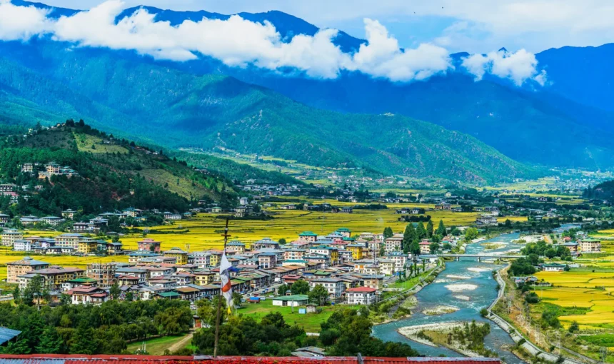
Bhutan is a small Himalayan kingdom covering about 38,394 square kilometers, yet its compact landscape contains an extraordinary range of environments. From subtropical foothills in the south to Himalayan peaks rising above 7,000 meters in the north, the country features lush valleys, dense forests, rushing rivers, alpine meadows, mountain passes, and remote trekking routes. This remarkable ecological diversity makes Bhutan one of the most rewarding destinations in the Himalayas.
Bhutan is administratively divided into 20 dzongkhags (districts) and can be broadly organized for travel into four geographic regions: Western, Central, Eastern, and Southern Bhutan. These are travel-oriented geographic groupings rather than official administrative regions. Each region has its character and attractions.
Western Bhutan is home to many of the country’s most famous cultural landmarks, including Paro, Thimphu, Punakha, Haa, and Chukha.
Central Bhutan is known for historic valleys, ancient temples, monasteries, dzongs, and traditional communities.
Eastern Bhutan offers quieter landscapes, distinctive village cultures, traditional crafts, and less-visited destinations, while Southern Bhutan features a warmer subtropical environment and important wildlife and conservation areas.
Bhutan’s natural environment is one of its greatest attractions. Extensive forests cover much of the country, while protected areas and biological corridors safeguard important habitats and wildlife.
The landscape supports ecosystems ranging from subtropical forests and temperate valleys to alpine environments above 4,000 meters. This remarkable variation makes Bhutan a rewarding destination for nature lovers, birdwatchers, photographers, hikers, and travelers interested in Himalayan wildlife.
Beyond its scenery, Bhutan offers a living cultural experience shaped by Buddhism, historic architecture, traditional festivals, and communities that continue many long-established customs. Visitors can explore ancient temples and fortress monasteries, walk through traditional villages, experience local festivals, discover mountain valleys, or trek into remote Himalayan landscapes.
In this guide, you will explore the best places to visit in Bhutan by region and destination, highlighting what makes each place special and helping you choose the right destinations for your itinerary.
1. Western Bhutan
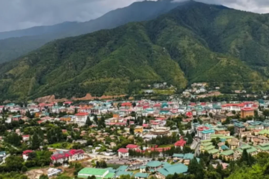
Western Bhutan forms the country’s historic and political heartland. For travel planning, this region includes Paro, Thimphu, Haa, Gasa, Punakha, Wangdue Phodrang, and Chukha. Together, these seven dzongkhags contain many of Bhutan’s most visited cultural landmarks, historic fortresses, sacred temples, fertile valleys, and important government centers.
The western region played a major role in Bhutan’s unification under Zhabdrung Ngawang Namgyal. Punakha served as Bhutan’s capital for several centuries, while Thimphu later became the permanent capital. Today, Western Bhutan is home to the country’s international airport, capital, major government institutions, historic dzongs, sacred temples, and many of its most popular destinations.
i. Paro
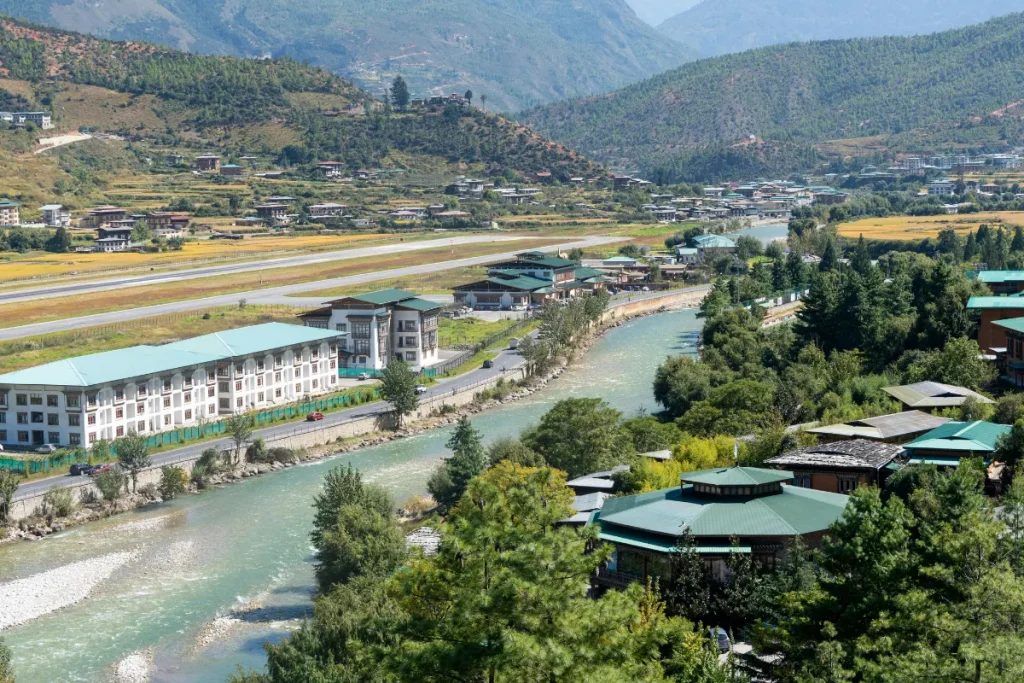
Paro is one of Bhutan’s most scenic and culturally important destinations. The valley combines traditional villages, green farmland, historic monasteries, fortress architecture, and dramatic mountain scenery. The peaceful Paro Chhu flows through the valley, adding to its scenic character. Paro is also home to Bhutan’s only international airport, making it the main gateway for most international travelers.
Visitors can explore Rinpung Dzong, discover the ancient Kyichu Lhakhang, and visit historic Drukgyel Dzong. Above all, Paro provides access to Taktshang Monastery, or Tiger’s Nest, Bhutan’s most iconic landmark. Its rich heritage and spectacular landscapes make Paro an essential stop on almost every Bhutan itinerary.
● Taktshang Monastery (Tiger’s Nest):
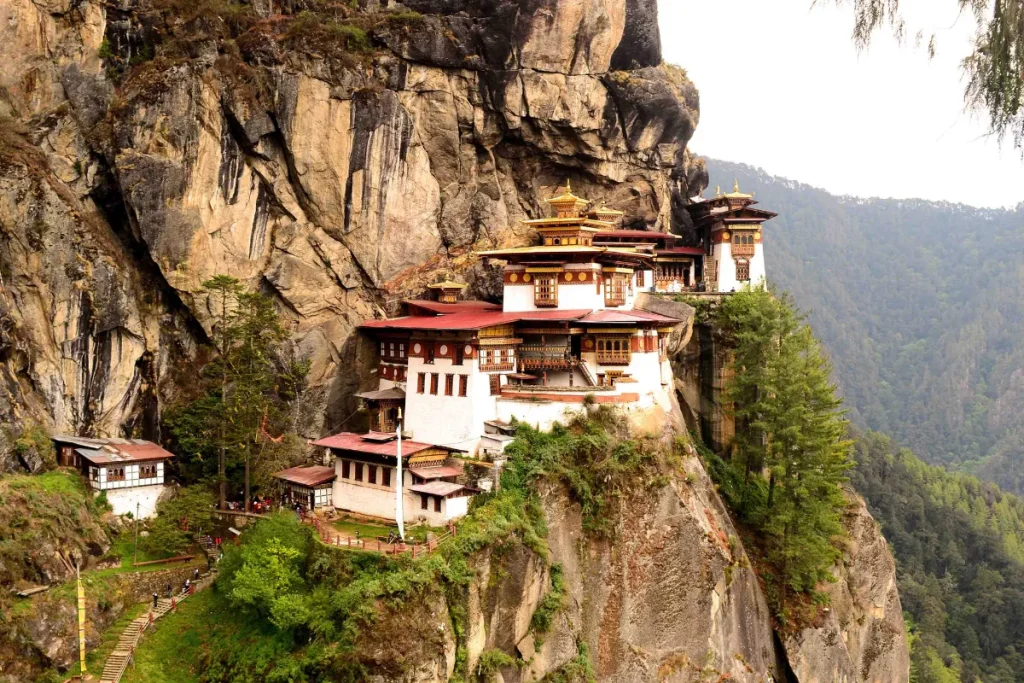
Taktshang Monastery, widely known as Tiger’s Nest, is Bhutan’s most famous landmark. The monastery sits dramatically on a cliff about 3,120 m above Paro Valley. Buddhist tradition links the site closely with Guru Rinpoche, who is believed to have meditated here in the 8th century.
Gyalse Tenzin Rabgye, the fourth Druk Desi, founded the present monastery complex in 1692 and completed it in 1694. Visitors reach the monastery by hiking uphill through pine forests. Several viewpoints along the trail offer beautiful views of the valley and surrounding mountains. The spectacular setting and deep spiritual importance make Tiger’s Nest a highlight of almost every Bhutan itinerary.
● Rinpung Dzong:
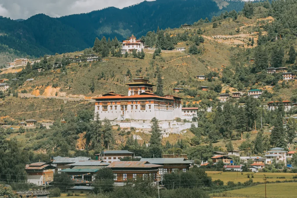
Rinpung Dzong stands as one of Paro’s most impressive architectural landmarks. Zhabdrung Ngawang Namgyal built the fortress monastery between 1644 and 1646. It overlooks Paro Valley and continues to serve as an important center of Buddhist practice and administration.
The dzong features large courtyards, traditional Bhutanese woodwork, painted interiors, and massive whitewashed walls. These features show the distinctive style of Bhutanese architecture. The dzong also offers beautiful views across the valley. Historically, it served as the seat of the Paro Penlop, the governor of western Bhutan.
● Ta Dzong – National Museum of Bhutan:
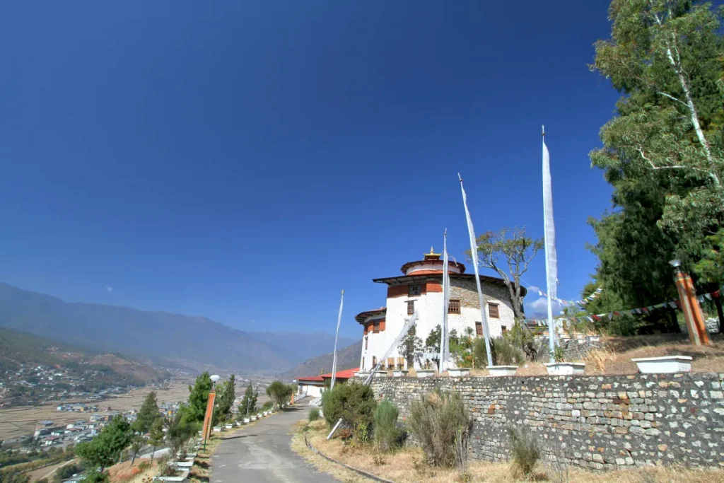
Ta Dzong is a historic watchtower that overlooks Rinpung Dzong. Today, it houses the National Museum of Bhutan. La Ngonpa Tenzin Drugdra, the first Paro Penlop, built the tower in 1649 as a defensive lookout. In 1960, the Third King, Jigme Dorji Wangchuck, ordered its renovation to house the National Museum of Bhutan. The museum opened in 1965 and welcomed the general public from 1968.
The museum preserves religious objects, traditional art, textiles, weapons, coins, and other cultural artifacts. These collections help visitors understand Bhutan’s history and heritage. The building itself also demonstrates Bhutan’s traditional defensive architecture.
● Kyichu Lhakhang:
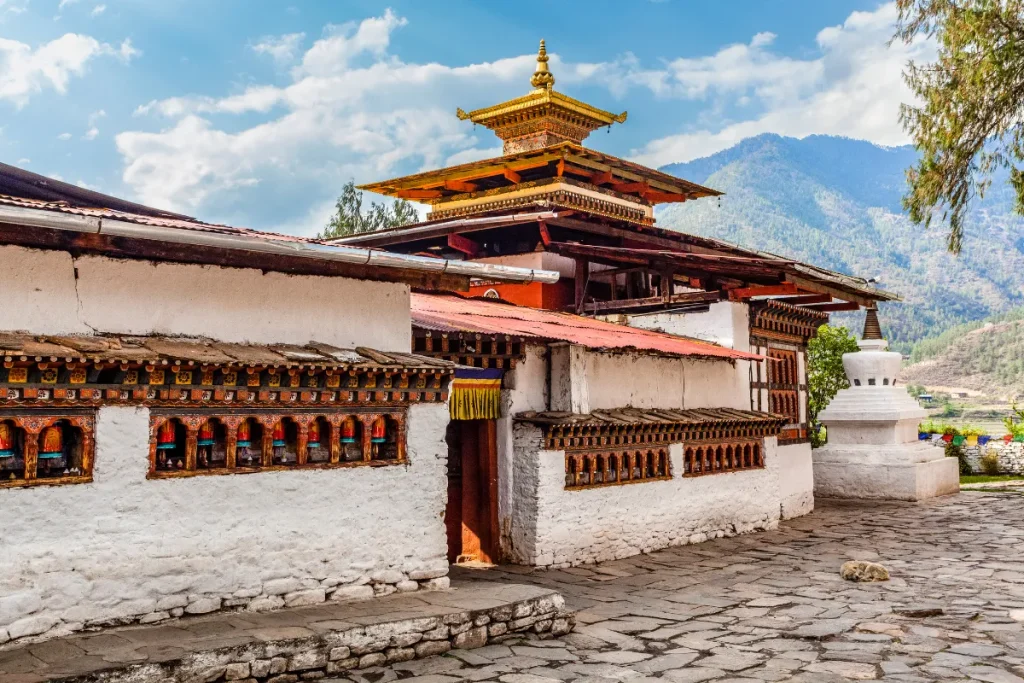
Kyichu Lhakhang ranks among Bhutan’s oldest and most sacred temples. The temple stands in Paro Valley and has a traditional connection with the seventh-century Tibetan king Songtsen Gampo. According to Bhutanese tradition, he built 108 temples across the Himalayas to subdue harmful forces.
The temple has a peaceful courtyard, prayer wheels, sacred statues, and long-standing religious traditions. These features make Kyichu Lhakhang an important stop for travelers interested in Bhutanese Buddhism and early Himalayan history.
● Drukgyel Dzong:
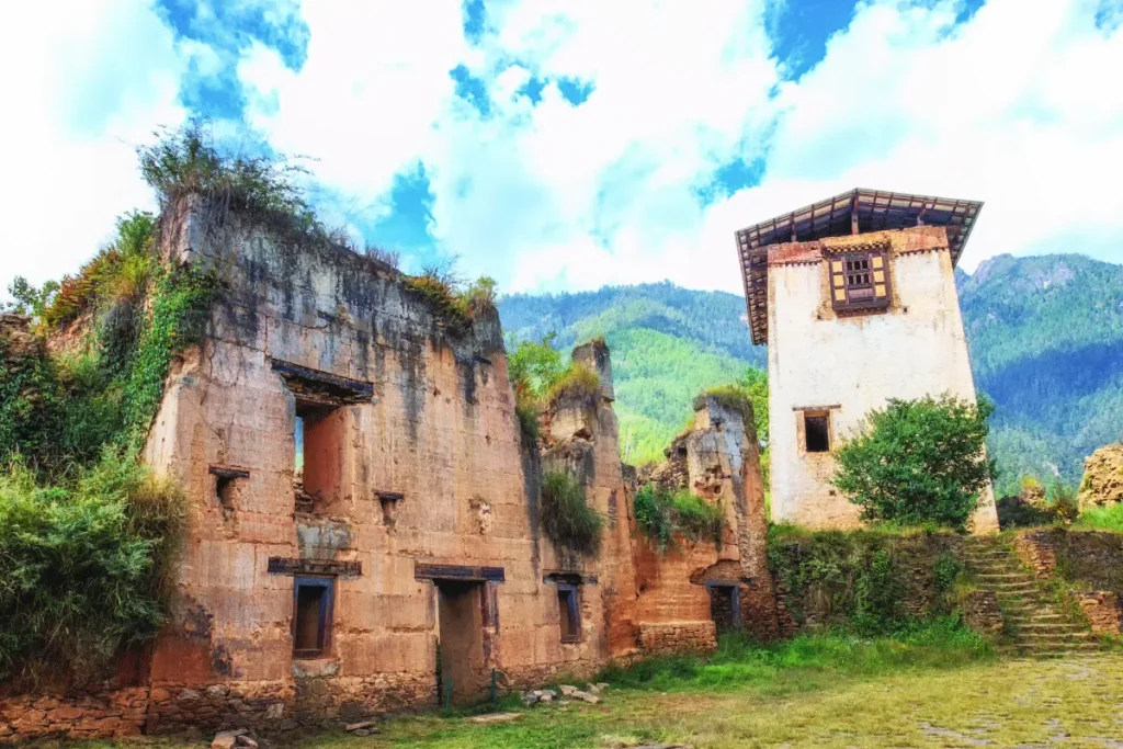
Drukgyel Dzong is a historic fortress in the upper Paro Valley. Zhabdrung Ngawang Namgyal built it in 1649 to defend the region against Tibetan invasions. The dzong played an important role in Bhutan’s military history.
In the 20th century, a fire destroyed much of the original structure. However, the remaining ruins and restored sections still demonstrate the dzong’s historical importance. On clear days, visitors can also see Mount Jomolhari from the area.
ii. Thimphu
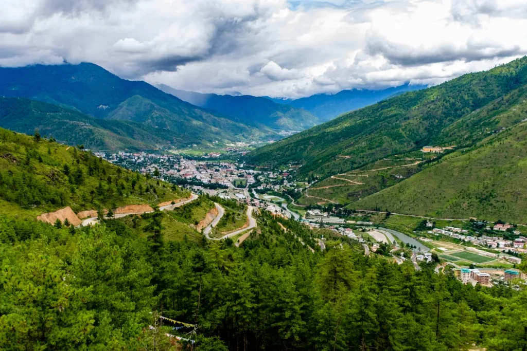
Thimphu is Bhutan’s capital and largest city, set along the Wang Chhu Valley. The city blends traditional Bhutanese architecture with government offices, monasteries, markets, museums, and lively local neighborhoods. Tashichho Dzong stands at the heart of Thimphu’s political and religious life and remains one of the city’s most important landmarks.
Thimphu became Bhutan’s capital in the mid-20th century, replacing Punakha as the country’s main political and administrative center. Today, visitors can explore the National Memorial Chorten, Buddha Dordenma, Changangkha Lhakhang, the National Library, and local markets. Thimphu offers a convenient introduction to Bhutan’s culture, traditions, and modern way of life.
● National Memorial Chorten:
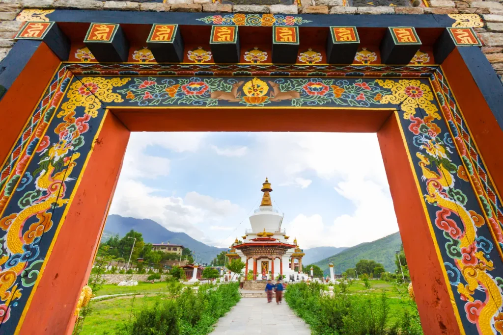
The National Memorial Chorten, often called the Thimphu Chorten, ranks among the city’s most visited religious landmarks. Bhutan built the chorten in 1974 to honor the Third Druk Gyalpo, Jigme Dorji Wangchuck, who died in 1972 and is remembered as the “Father of Modern Bhutan.” The monument serves as a memorial rather than a tomb because it contains no royal remains. The chorten follows the classic Tibetan stupa design. Its whitewashed base and golden spire surround mandalas and paintings of Vajrayana deities.
Throughout the day, especially in the morning and evening, Thimphu residents walk around the chorten clockwise, turn prayer wheels, and recite mantras. Their daily practice gives the site a strong sense of living faith.
● Tashichho Dzong:
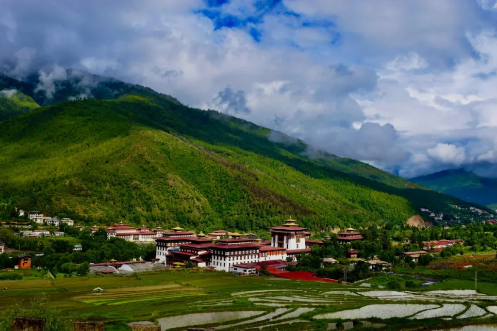
Tashichho Dzong is Thimphu’s most important fortress monastery and the formal seat of Bhutan’s government. The original dzong dates to the 13th century, while builders created the present structure during the 1960s. The dzong houses the king’s throne room, several government ministries, and the summer residence of the Je Khenpo, Bhutan’s chief abbot. Its whitewashed walls, golden towers, and traditional Bhutanese design make it one of the capital’s most striking buildings. The dzong also hosts the annual Thimphu Tshechu festival.
● Simtokha Dzong:
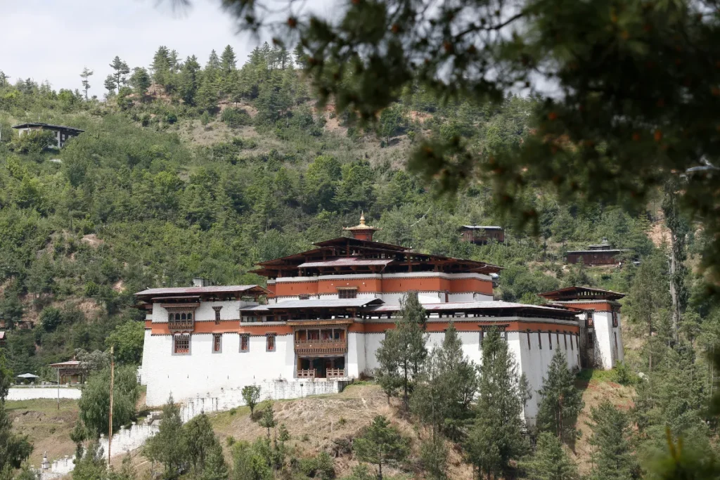
Simtokha Dzong holds a special place in Bhutanese history as the country’s first dzong. Zhabdrung Ngawang Namgyal built it in 1629, shortly after he began unifying Bhutan. Its formal name, Sangak Zabkhar Rinchen Phodrang, means “Palace of the Profound Meaning of Secret Mantras.”
The dzong guards the southern approach to the Thimphu Valley. It combines religious, administrative, and defensive functions in one structure. Later, dzongs across Bhutan followed this model.
Today, the Institute for Language and Culture Studies uses the dzong to train students in Dzongkha and Buddhist philosophy. Visitors can admire its carved slate reliefs and painted interiors.
● Changangkha Lhakhang:
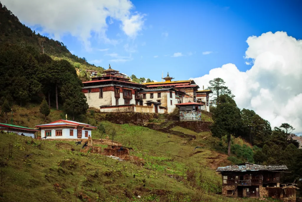
Changangkha Lhakhang is one of the oldest temples in the Thimphu Valley. Lama Phajo Drugom Zhigpo founded it in the 12th century after introducing the Drukpa Kagyu lineage to Bhutan. The temple stands on a ridge above the city and honors Chenrezig, the bodhisattva of compassion, in his eleven-headed and thousand-armed form.
The temple is especially known for infant blessings. Parents bring newborns to the temple during their first weeks to receive blessings and, often, their first name from resident monks. The hilltop location also gives visitors wide views across Thimphu and the surrounding mountains.
● National Library of Bhutan:
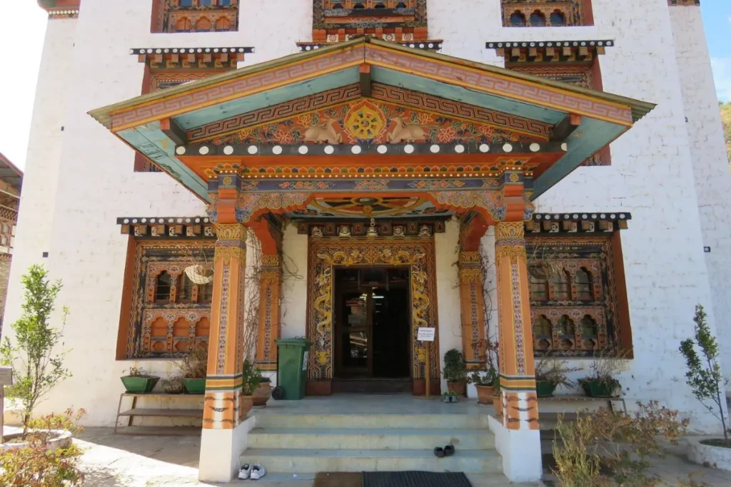
The National Library of Bhutan began its work in 1967. It protects Buddhist scriptures, historical manuscripts, and traditional literature. Its collection includes Choekey and Dzongkha texts, many of which were produced through traditional woodblock printing. The building also preserves religious paintings and centuries-old documents.
The library displays “Bhutan,” a photographic book by Michael Hawley that became known as one of the largest published books in the world. A custom viewing stand holds the book for visitors. Travelers interested in Bhutanese scholarship and heritage can enjoy the library as a quieter alternative to the city’s dzongs and temples.
iii. Punakha
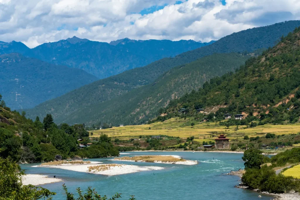
Punakha is one of Bhutan’s most scenic valleys, known for its warmer climate, fertile farmland, and historic landmarks. Punakha served as Bhutan’s capital from the 17th century until 1955, and the valley remains closely connected to the country’s royal and religious history.
Punakha Dzong stands where the Pho Chhu and Mo Chhu rivers meet, creating one of Bhutan’s most memorable landscapes. Visitors can cross the traditional cantilever bridge, explore the dzong, and walk through surrounding rice fields and orchards. The valley also hosts the Punakha Drubchen and Punakha Tshechu, which bring local traditions and Buddhist culture to life through religious ceremonies, dances, and community celebrations.
● Punakha Dzong:
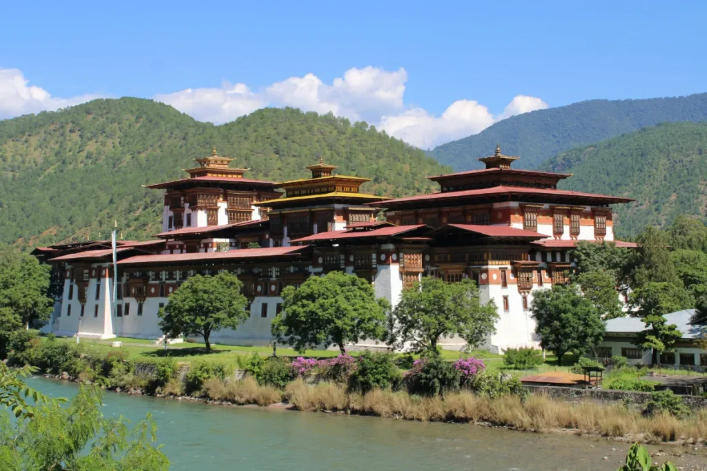
Punakha Dzong, formerly known as Pungthang Dechen Photrang (“Palace of Great Happiness”), stands at the confluence of the Pho Chhu and Mo Chhu rivers. Zhabdrung Ngawang Namgyal built it in 1637–38. It ranks among Bhutan’s largest dzongs. The six-story central tower, or utse, rises about 21 meters above the river confluence.
A traditional wooden cantilever bridge connects the dzong with the valley. The dzong has survived four major fires and a glacial lake outburst flood in 1994. Careful restoration has preserved its detailed woodwork and murals. Today, it houses sacred relics of the Drukpa Kagyu lineage and serves as the winter seat of Bhutan’s central monastic body.
● Khamsum Yulley Namgyal Chorten:
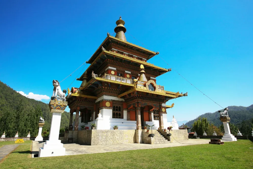
Khamsum Yulley Namgyal Chorten is a three-story stupa commissioned by Queen Mother Ashi Tshering Yangdon Wangchuck. Builders took nine years to complete the project. The chorten aims to remove negative forces and promote peace, prosperity, and harmony in Bhutan. Its three levels contain detailed statues and murals of Vajrayana deities.
Visitors reach the chorten after a roughly 45- to 60-minute walk from the valley floor. The trail crosses a suspension bridge over the Mo Chhu and passes through rice fields and farmland. The climb ends with wide views over Punakha Valley, making this one of the region’s most popular short hikes.
iv. Haa Valley
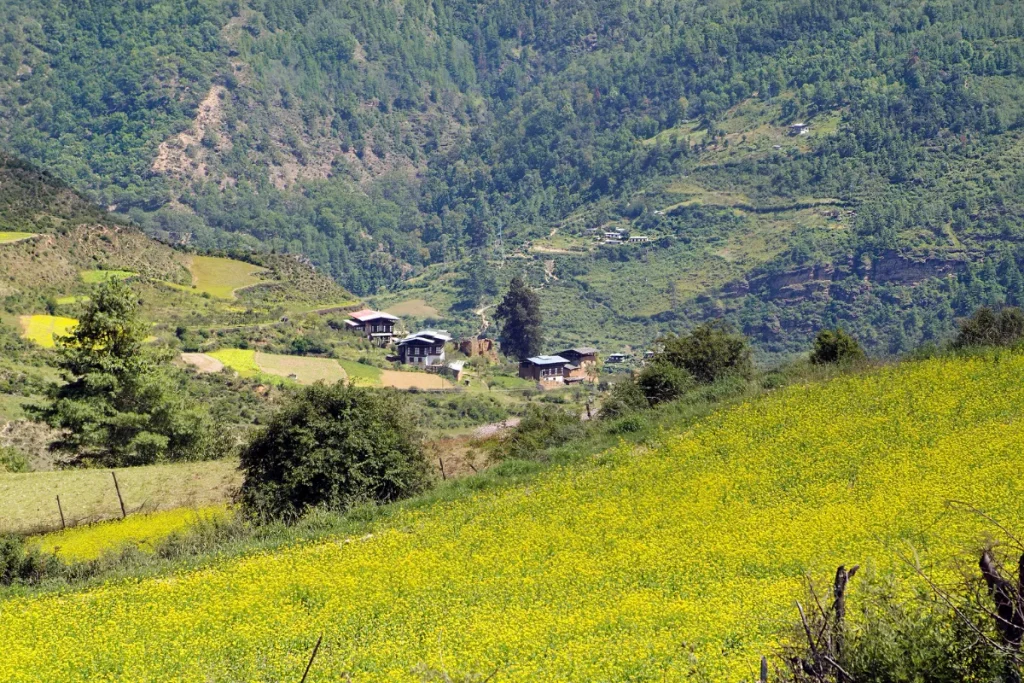
Haa Valley lies in western Bhutan near the Tibetan border and remains one of the country’s quieter destinations. Bhutan once restricted access to the valley because of its remote border location, helping preserve its traditional character and peaceful atmosphere. Haa is home to Lhakhang Karpo, or White Temple, and Lhakhang Nagpo, or Black Temple.
Buddhist tradition dates both temples to the 7th century and connects them with the Tibetan king Songtsen Gampo. Forested mountains, open valleys, and traditional villages surround Haa, offering travelers a slower and more authentic experience away from Bhutan’s busier tourist centers.
v. Wangdue Phodrang
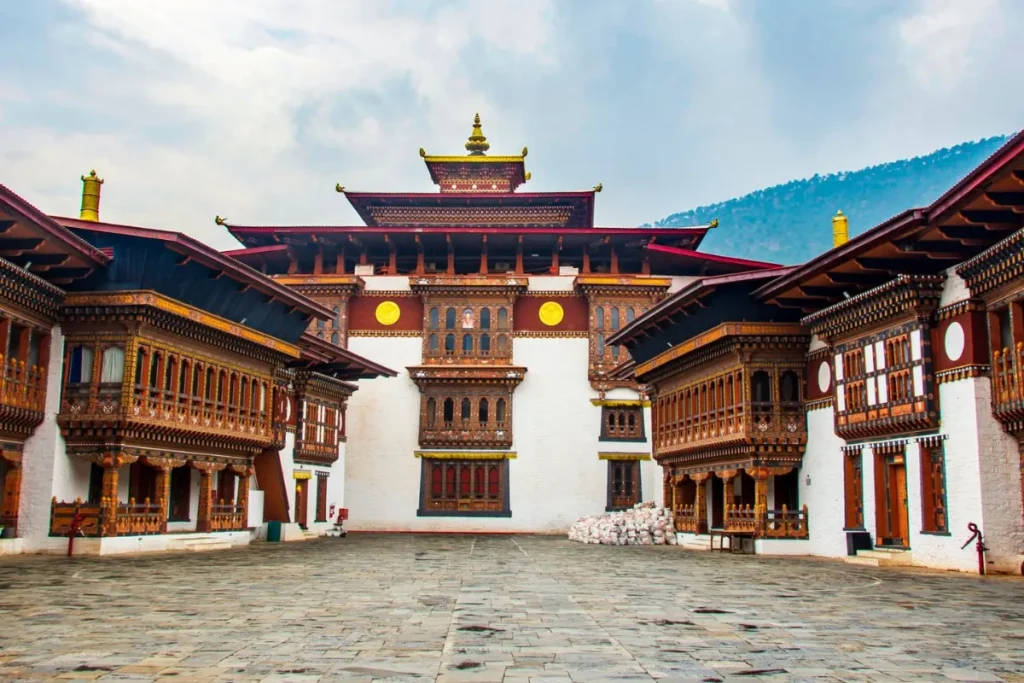
Wangdue Phodrang is known for its historic dzong, scenic valleys, and access to some of western Bhutan’s most beautiful rural landscapes. Zhabdrung Ngawang Namgyal built Wangdue Phodrang Dzong in 1638 on a strategic ridge overlooking the valley. A major fire damaged the historic fortress in 2012, and extensive restoration has since brought the dzong back to life.
Wangdue Phodrang also provides access to Phobjikha Valley and Gangtey, making it a popular stop for travelers heading toward the Black Mountains. The region combines mountain scenery, traditional settlements, farmland, and important cultural landmarks.
● Phobjikha Valley:
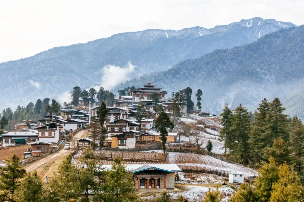
Phobjikha Valley is a broad, U-shaped glacial valley at roughly 3,000 meters above sea level. The valley lies within the Wangdue Phodrang district and forms part of Jigme Singye Wangchuck National Park. The valley is best known as an important wintering ground for the endangered black-necked crane.
An estimated 300 to 400 cranes arrive from the Tibetan Plateau each year, usually between late October and mid-February. Bhutan protects the cranes’ flight paths by keeping overhead electricity lines out of the valley. Instead, workers run the power cables underground.
The valley’s open meadows, traditional farmhouses, and surrounding forests create an impressive landscape. Each November 11, the Black-Necked Crane Festival takes place in Gangtey Monastery’s courtyard.
● Gangtey:
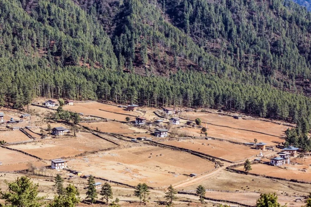
Gangtey is a small settlement at roughly 3,000 meters above sea level. The village sits on a ridge overlooking Phobjikha Valley and serves as the valley’s main village and visitor base. Gangtey is home to Gangtey Goenpa, one of the largest Nyingma monastic seats in western Bhutan.
The community also has a distinctive monastic tradition because many resident monks follow a Nyingma tradition that permits marriage, unlike the celibate communities found elsewhere in Bhutan. The village also serves as a base for walking trails such as the popular Gangtey Nature Trail. Its elevated location makes it especially appealing for crane watching in winter and hiking in autumn.
● Gangtey Monastery:
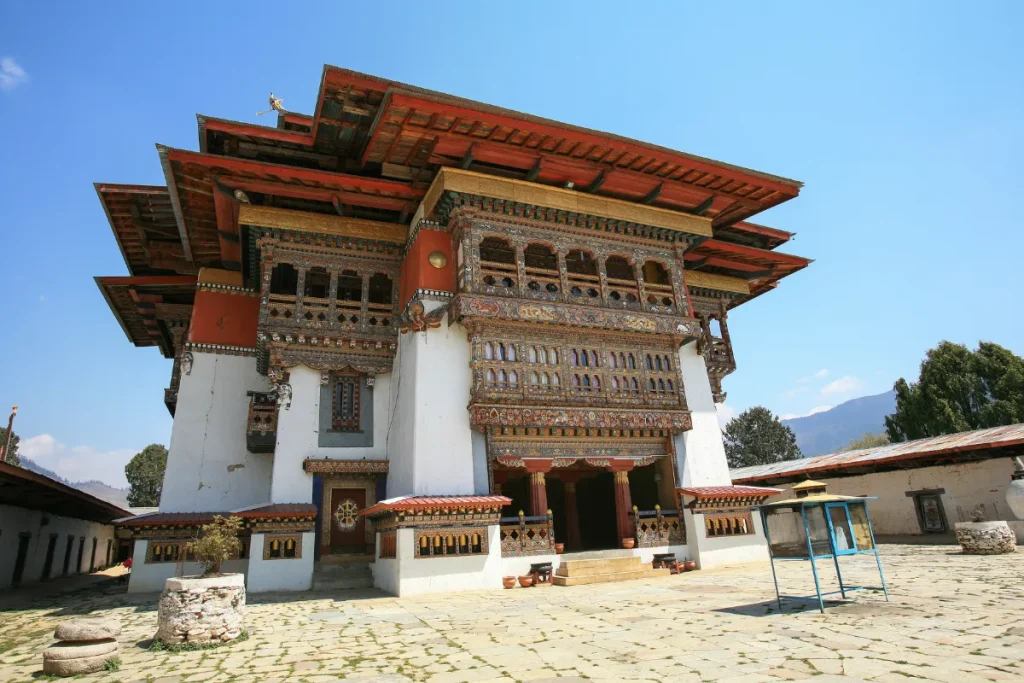
Gangtey Monastery, also called Gangtey Goenpa, dates to 1613. Gyalse Pema Thinley, the grandson and principal reincarnation of Buddhist treasure-revealer Pema Lingpa, founded the monastery. It became the seat of the Peling Nyingma lineage in western Bhutan.
The Gangtey monastery ranks among Bhutan’s largest Nyingma institutions and remains led by the Gangteng Trulku. The current leader represents the ninth incarnation of the lineage.
A major renovation project restored the monastery in 2008 after nearly a decade of work. The monastery sits on a ridge above Phobjikha Valley and provides wide views across the wintering grounds of the black-necked cranes.
vi. Gasa
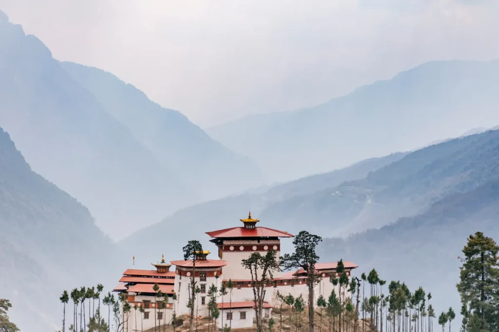
Gasa lies in northwestern Bhutan and offers some of the country’s most remote and rugged landscapes. Much of the region lies within Jigme Dorji National Park, with forested mountains, high valleys, and traditional villages creating a strong sense of wilderness.
Gasa Dzong is an important historic fortress associated with Zhabdrung Ngawang Namgyal and Bhutan’s early history of defending its borders. Travelers can also visit Gasa Tshachu, a natural hot spring that local communities have long valued. With its peaceful surroundings, mountain landscapes, and limited tourist traffic, Gasa is an excellent choice for travelers seeking a quieter side of Bhutan.
vii. Chukha
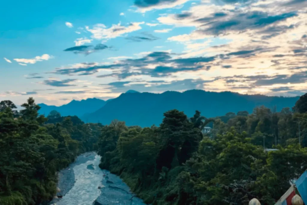
Chukha lies in western Bhutan along the route between Phuentsholing and Thimphu. The region combines forested mountains, river valleys, and subtropical landscapes, creating a natural transition between southern Bhutan and the higher valleys farther north. Chukha also played an important role in Bhutan’s modern economic development through hydropower.
The Chukha Hydropower Project, which began operation in 1986, became an important source of electricity and revenue for the country. For travelers, Chukha offers scenic landscapes and a glimpse of the infrastructure and communities that connect southern Bhutan with the country’s western heartland.
2. Central Bhutan
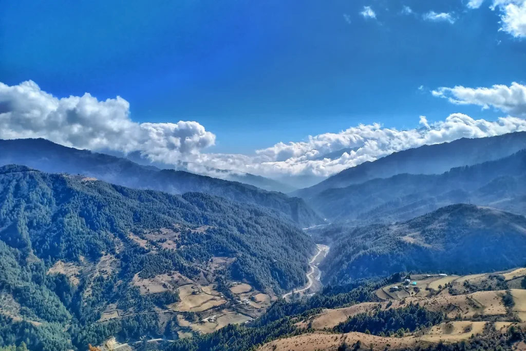
Central Bhutan forms an important historic and spiritual heartland between western and eastern Bhutan. For travel planning, this region includes Trongsa and Bumthang and covers approximately 4,478 square kilometers. Historically, Trongsa served as a major political center and the seat of the Trongsa Penlop.
Bumthang developed into one of Bhutan’s most important Buddhist regions, with sacred sites linked to Guru Rinpoche and Pema Lingpa. Together, Trongsa and Bumthang offer historic dzongs, ancient temples, fertile valleys, traditional communities, and dramatic Himalayan landscapes.
i. Trongsa
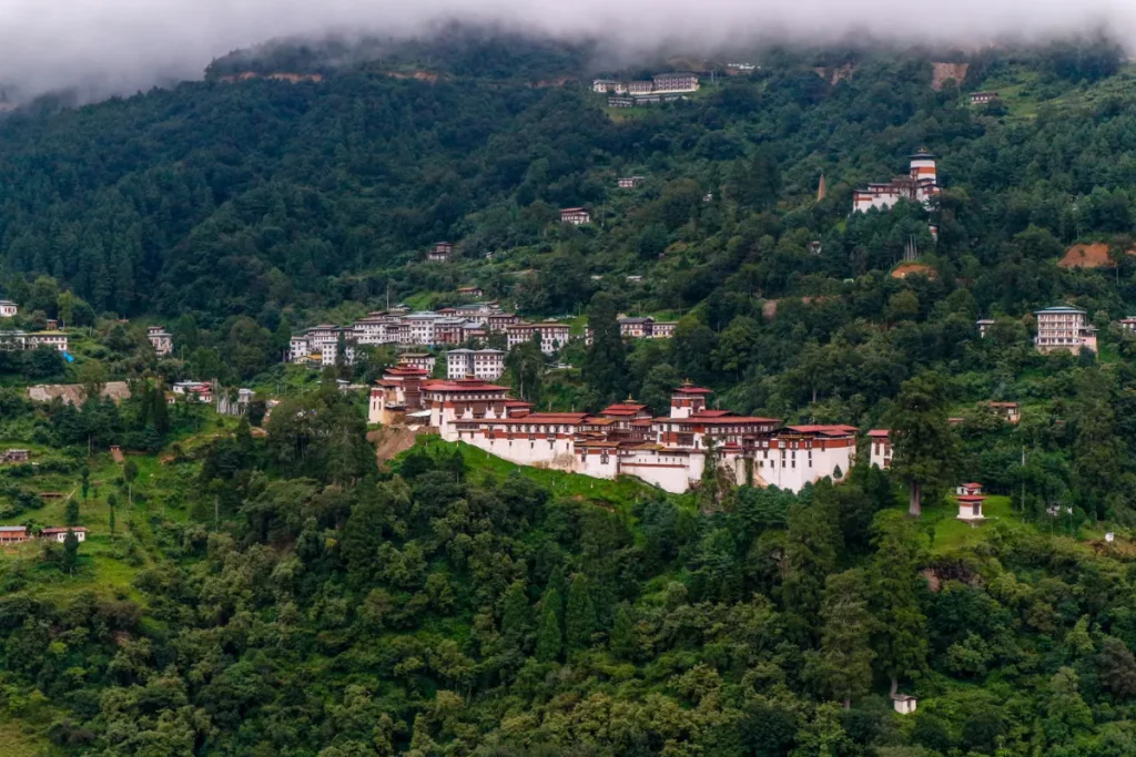
Trongsa is a historic mountain town in central Bhutan, built above the deep Mangde Chhu gorge. Its strategic location along the traditional route between western and eastern Bhutan made it an important center of political power.
Trongsa Dzong dominates the surrounding landscape and has played a major role in Bhutan’s history. The town was closely associated with the Trongsa Penlop, a powerful governor whose position became linked with the country’s monarchy. Both Ugyen Wangchuck and his successor, Jigme Wangchuck, held the post before becoming kings. Today, travelers visit Trongsa for its impressive dzong, dramatic mountain scenery, and strong connection to Bhutan’s monarchical history.
● Trongsa Dzong:
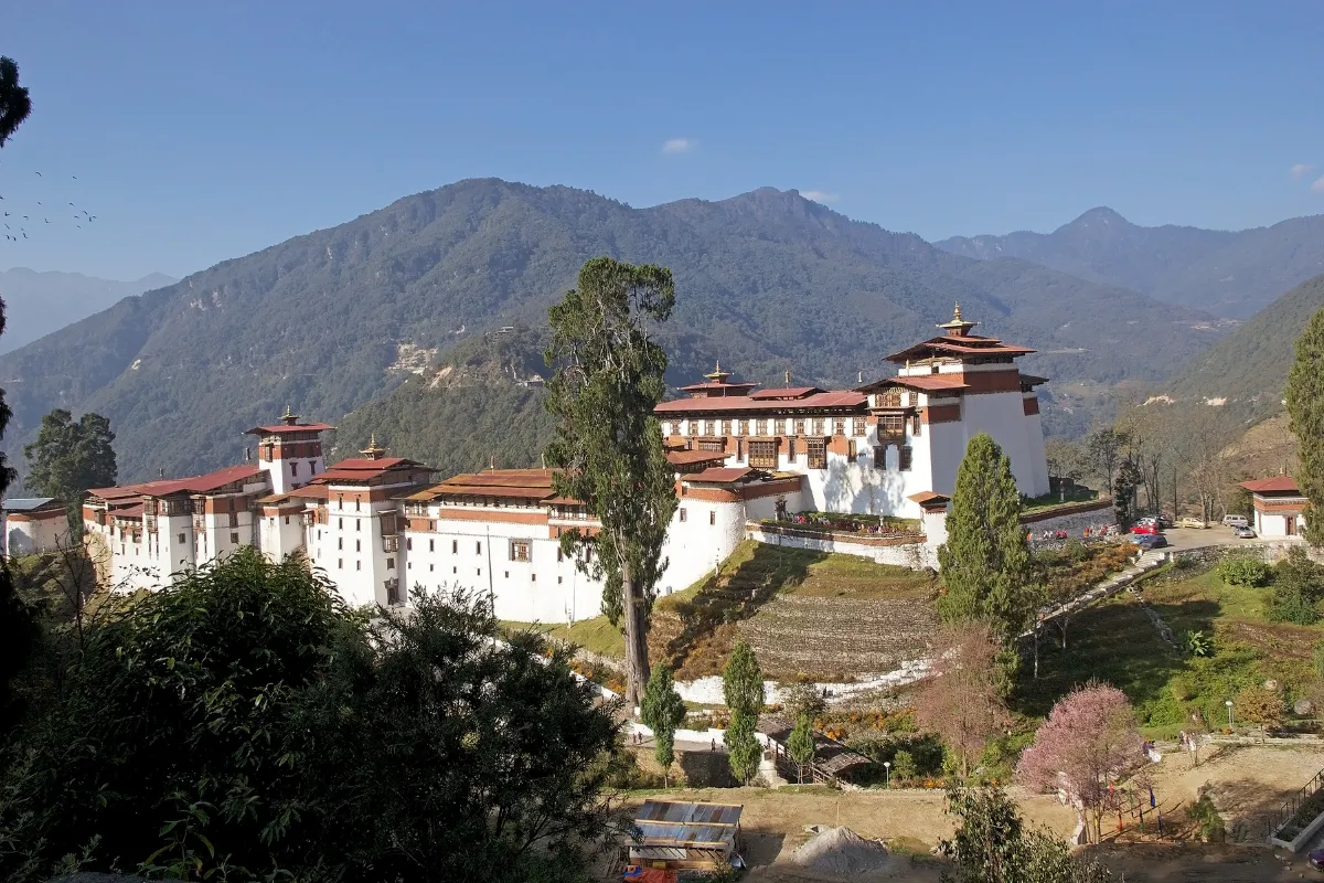
Trongsa Dzong ranks among Bhutan’s largest and most important fortress monasteries. The original temple dates to the 16th century, while later rulers expanded the main fortress over several generations.
Builders placed the dzong along a steep mountain ridge above the Mangde Chhu Valley. Its position allowed the fortress to control the historic east-west route while serving religious and administrative purposes.
The dzong contains maze-like courtyards, more than 20 temples and chapels, defensive towers, administrative buildings, and traditional woodwork. These features show the distinctive architecture of Bhutan’s dzongs. The Trongsa Penlop also traditionally became the next Druk Gyalpo, which strengthened the dzong’s political importance.
● Ta Dzong, Trongsa:
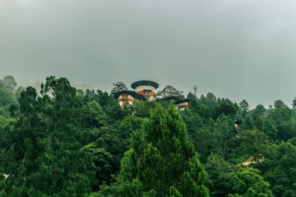
Ta Dzong is a historic watchtower and defensive fortress above Trongsa Dzong. Builders created it to strengthen defenses around the strategically important Trongsa region. Guards were able to monitor the surrounding valleys and mountain routes thanks to their high position.
Today, the Ta Dzong houses the Royal Heritage Museum. Visitors can learn about Bhutanese history, Buddhism, the monarchy, and the Wangchuck dynasty through religious objects, royal artifacts, weapons, and other exhibits.
The tower also offers panoramic views of Trongsa Dzong, Trongsa town, the Mangde Chhu Valley, and the surrounding mountains. This makes it an important cultural and historical stop in central Bhutan.
ii. Bumthang
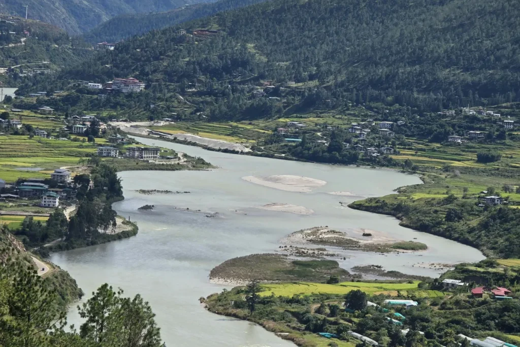
Bumthang is one of Bhutan’s most important spiritual and cultural regions. Often described as the spiritual heartland of the country, it is home to ancient temples, monasteries, fertile valleys, traditional villages, and communities that have preserved Bhutanese customs for generations.
According to tradition, Guru Rinpoche visited Bumthang in the 8th century and helped establish Buddhism in the region. The revered Bhutanese tertön Pema Lingpa was born in the Tang Valley. Jambay Lhakhang, traditionally dated to the 7th century, and Kurjey Lhakhang are among its most important sacred sites.
Bumthang also offers traditional weaving, local food, farming communities, and peaceful valley landscapes that give travelers a deeper connection to Bhutanese culture.
● Jakar:
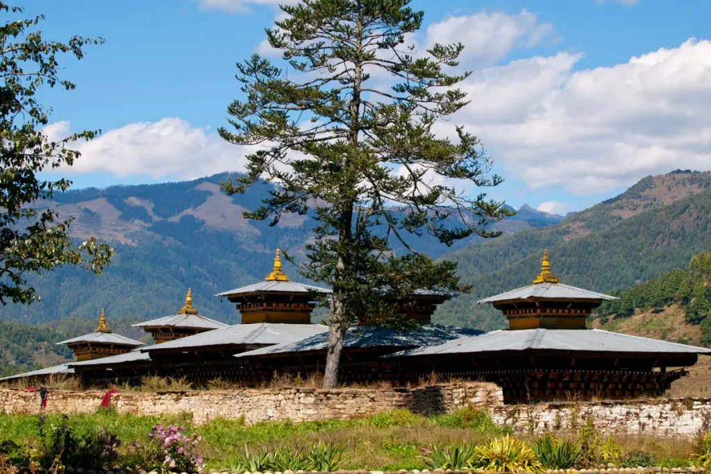
Jakar serves as the main town and administrative center of Bumthang. It sits in Chokhor Valley at roughly 2,800 meters above sea level and provides a convenient base for exploring the region’s major temples, monasteries, and cultural sites.
Jakar’s history is closely connected to Jakar Dzong, which overlooks the valley and has long served as an important administrative and religious center.
Chokhor Gewog remains an important farming area. Local farmers grow wheat, barley, potatoes, vegetables, and other crops. Today, Jakar combines a small-town atmosphere with traditional farms, monasteries, historic buildings, and mountain scenery.
● Jakar Dzong:
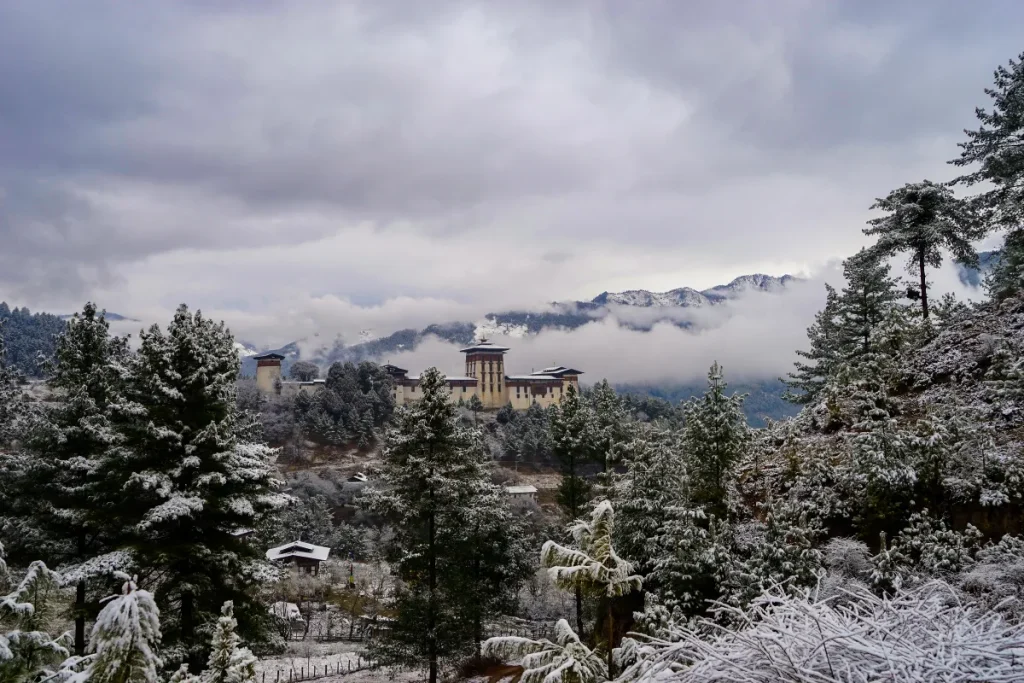
Jakar Dzong, traditionally known as the Castle of the White Bird, stands on a ridge above Chokhor Valley. It ranks among Bumthang’s most important historic landmarks. According to local tradition, the site has a long connection with the arrival of Buddhism in the region. Over time, builders transformed it into a major fortress and administrative center.
The dzong has served as a local government center and continues to play an important religious role. Its high position shows the strategic importance of Chokhor Valley. Visitors can explore its courtyards, temples, defensive structures, and traditional Bhutanese architecture while enjoying wide views across the valley.
● Kurjey Lhakhang:
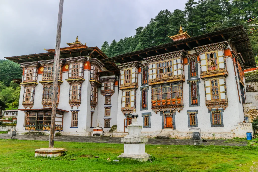
Kurjey Lhakhang ranks among Bumthang’s most sacred Buddhist sites. The temple has a strong connection with Guru Padmasambhava, also known as Guru Rinpoche. According to local tradition, Guru Rinpoche meditated here in the 8th century and left the imprint of his body on a rock. This story gave the site its name, which means “body imprint.”
The complex contains three temples: Guru Lhakhang, Sampa Lhundrup Lhakhang, and Ka Goen Phur Sum Lhakhang. Sindhu Raja, a ruler associated with early Buddhist history in Bumthang, established the oldest temple. Kurjey also has an important connection with Bhutan’s monarchy. Tradition describes the site as the final resting place of the first three kings of Bhutan.
● Jambay Lhakhang:
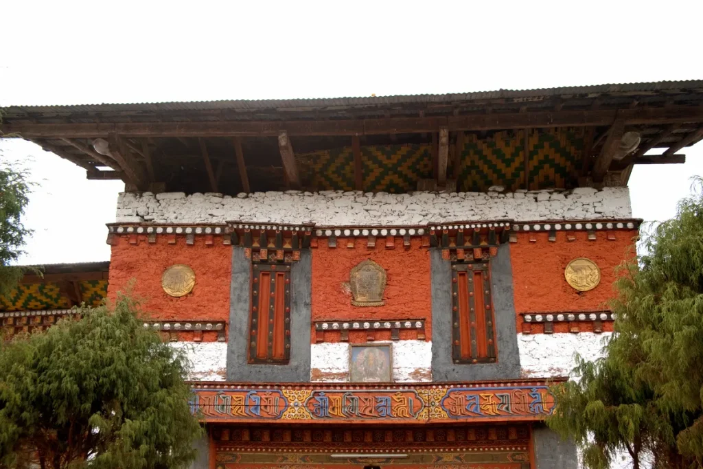
Jambay Lhakhang is traditionally regarded as one of Bhutan’s oldest temples. Tradition attributes its foundation to Tibetan King Songtsen Gampo in 659 CE. According to Bhutanese tradition, the king built the temple as one of 108 temples to subdue a demoness and to support the spread of Buddhism across the Himalayan region.
Tradition also connects Jambay Lhakhang with Padmasambhava. The temple remains an important pilgrimage site and hosts the annual Jambay Lhakhang Drup. The festival features masked dances, religious rituals, and traditional ceremonies. Its long history makes Jambay Lhakhang an important place for understanding the early development of Buddhism in Bhutan.
● Tamshing Lhakhang:
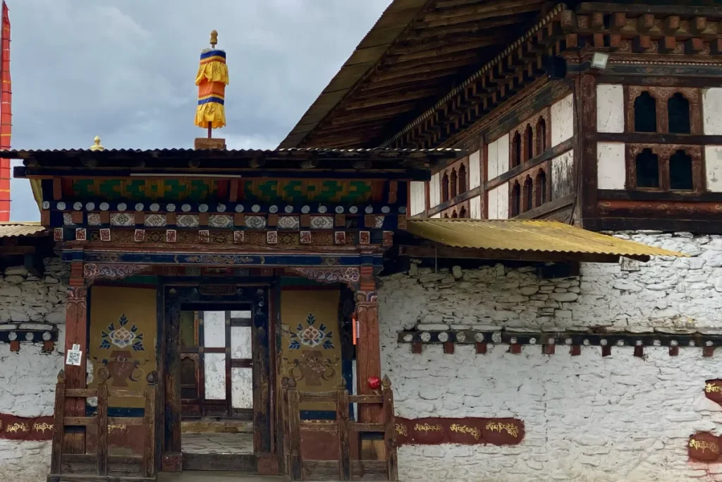
Tamshing Lhakhang, also known as Tamsing Monastery, is one of Bumthang’s most important sites connected with Pema Lingpa (1450–1521), Bhutan’s renowned treasure discoverer and Buddhist master. Pema Lingpa established the monastery in the early 16th century. It later became an important center of the Nyingma tradition.
The temple contains historic religious paintings, murals, and sacred objects. These works give visitors insight into Bhutan’s early Buddhist art and traditions.
Tamshing remains an active religious institution and continues to preserve centuries-old practices. Its peaceful setting and strong connection with Pema Lingpa make it an important cultural and spiritual destination in Chokhor Valley.
● Ura Valley:
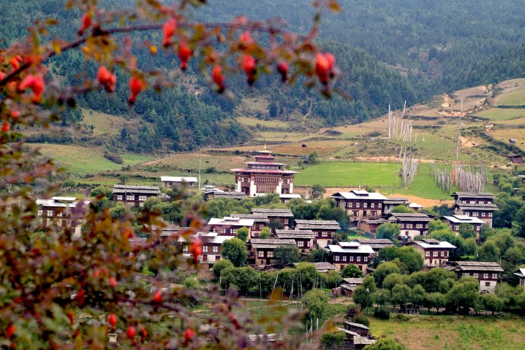
Ura Valley is one of Bumthang’s most settled valleys. The area features traditional villages, open farmland, stone houses, and wide mountain views. Ura Gewog covers about 265.6 km² and sits at approximately 3,101 meters above sea level. More than 80% of the area has forest cover, according to local government data.
The valley contains 10 major villages. Farming and livestock remain important parts of local life. Community temples and religious sites also add cultural depth. Ura gives travelers a slower and more personal experience of Bhutan. Walking through its villages and farmland allows visitors to see traditional buildings, farming practices, and everyday rural life.
● Tang Valley:
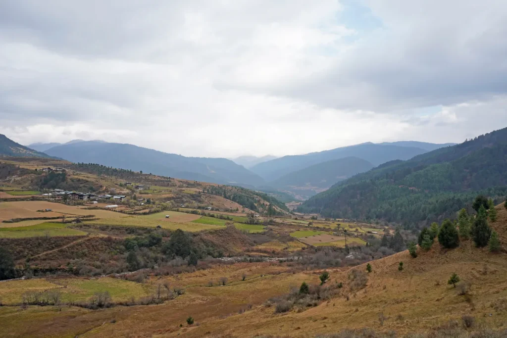
Tang Valley forms the northernmost of Bumthang’s four main valleys. It is known for remote villages, forests, farmland, and its strong connection with Pema Lingpa. Tang Gewog covers about 511 km². Elevations range from approximately 2,800 meters to 5,000 meters, and the area contains around 32 villages.
Agriculture and livestock remain important local livelihoods. Farmers produce wheat, barley, buckwheat, potatoes, apples, and other crops. Pema Lingpa was born in Bumthang in the 15th century, and several religious and cultural sites in the wider Tang Valley connect with his tradition.
The valley combines high mountain scenery, farming communities, and Buddhist heritage. It is an excellent choice for travelers who want to experience a quieter side of Bumthang.
3. Eastern Bhutan
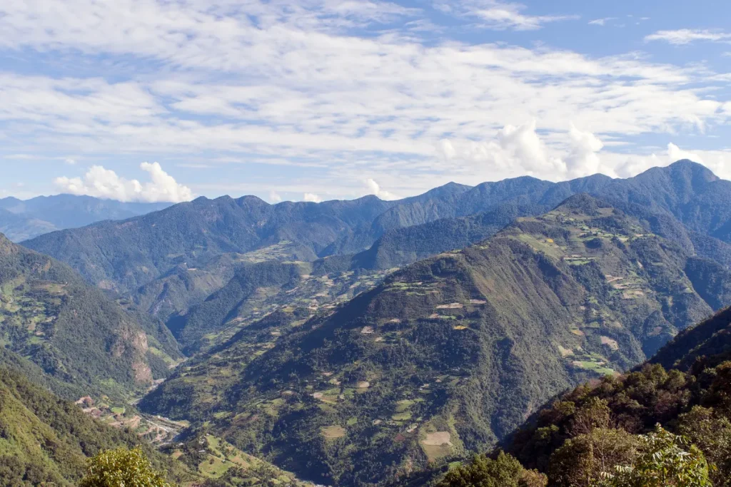
Eastern Bhutan forms a historically rich and geographically diverse travel region. For travel planning, it includes Mongar, Trashigang, Trashiyangtse, Lhuentse, Pemagatshel, and Samdrup Jongkhar. The region also includes distinctive destinations, such as the highland communities of Merak and Sakteng, located in Trashigang.
Much of Eastern Bhutan has steep mountain terrain, with landscapes ranging from subtropical foothills to high alpine areas.
Traditional trade and pilgrimage routes once connected Eastern Bhutan with central Bhutan and other Himalayan regions. Trashigang Dzong became an important administrative and strategic center, while Lhuentse has a close connection with Bhutan’s royal history.
Today, Eastern Bhutan is known for traditional villages, weaving, Buddhist heritage, distinctive communities, and protected mountain ecosystems.
i. Mongar
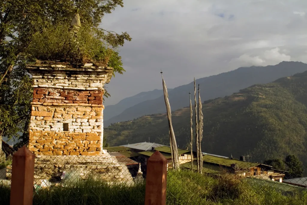
Mongar is an important administrative and commercial center in eastern Bhutan. The town sits at approximately 1,600 meters above sea level on a steep mountainside overlooking the surrounding valleys. Unlike many Bhutanese towns that developed on broad valley floors, Mongar grew along a hillside.
This location gives the town wide views of the surrounding mountains. Mongar Dzongkhag covers about 1,940 km² and includes 17 gewogs. Historically, the area formed part of important routes between central and eastern Bhutan.
Today, Mongar serves as a major stop between Trongsa and Trashigang. Travelers can use the town as a base for visiting traditional villages, Buddhist sites, forests, and mountain landscapes.
● Mongar Dzong:
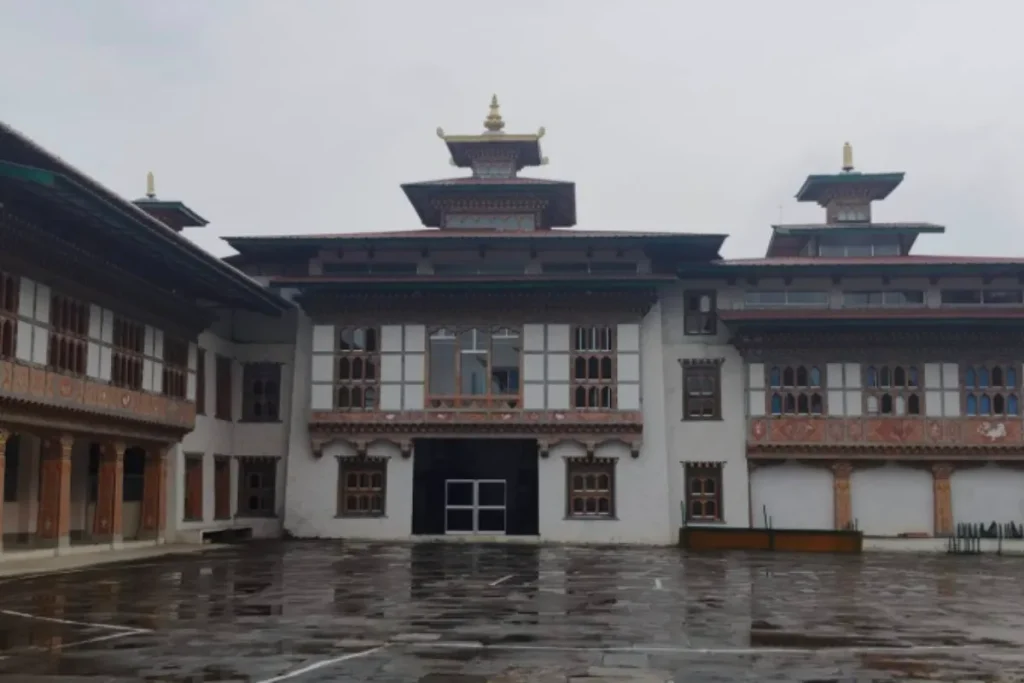
Mongar Dzong is a distinctive fortress monastery known for its hillside setting above Mongar town. Unlike many older dzongs that occupy strategic ridges or valley floors, the present structure dates to the 20th century. The Second King, Jigme Wangchuck, oversaw its construction in 1930.
Later work renovated and expanded the dzong. Today, the dzong serves both religious and administrative functions. Its compact courtyards, temples, whitewashed walls, and traditional timber details show how Bhutanese architects adapted dzong design to the steep terrain of eastern Bhutan.
ii. Trashigang
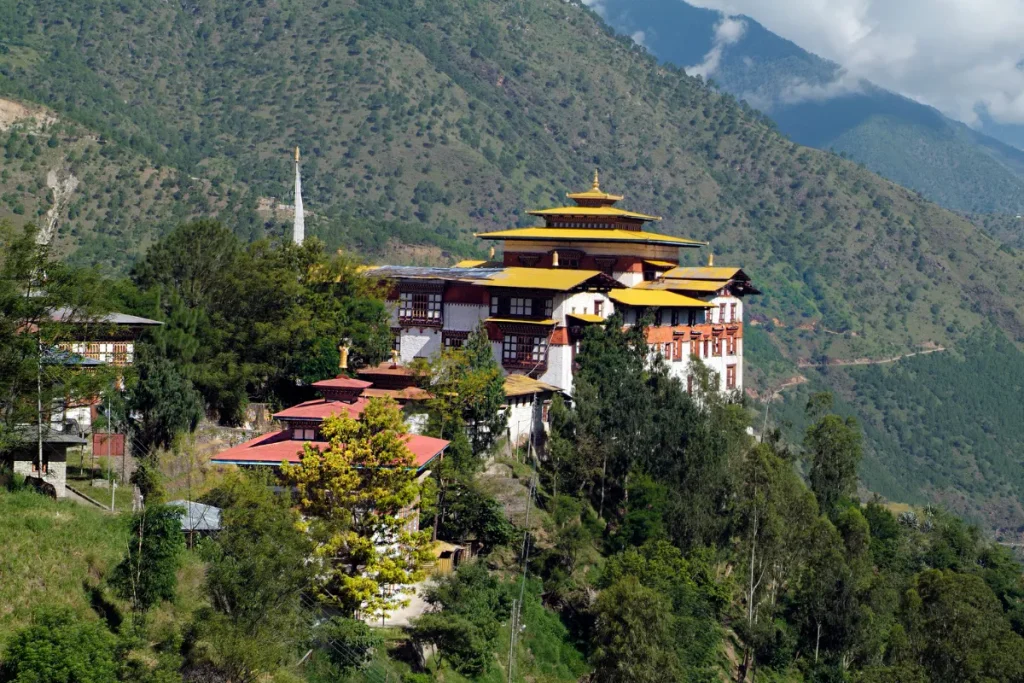
Trashigang is one of eastern Bhutan’s main administrative and cultural centers. The town sits at approximately 1,150 meters above sea level and overlooks the Dangme Chhu Valley. Trashigang Dzongkhag covers about 2,500 km² and includes 15 gewogs.
Historically, the area developed as an important political and trading center along routes that connected eastern Bhutan with other Himalayan regions. Today, travelers reach Trashigang by following steep mountain roads through forested hills, traditional settlements, and dramatic river valleys. This journey makes Trashigang an important part of an eastern Bhutan itinerary.
● Trashigang Dzong:
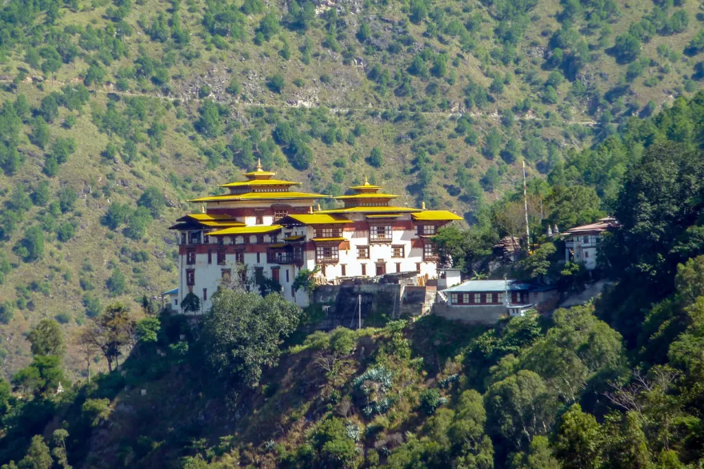
Trashigang Dzong is one of eastern Bhutan’s most important historic fortress monasteries. The original fortress dates to the 17th century, during the period of Zhabdrung Ngawang Namgyal. The dzong’s position above the Dangme Chhu Valley helped Bhutan strengthen its administration in the east. It later became the administrative center of Trashigang and an important religious institution.
The complex contains traditional courtyards, temples, administrative buildings, whitewashed walls, and timber architecture. Its elevated position also gave it a strong defensive advantage. Today, the dzong continues to support both religious activities and district administration. It remains one of eastern Bhutan’s most important architectural landmarks.
● Trashiyangtse
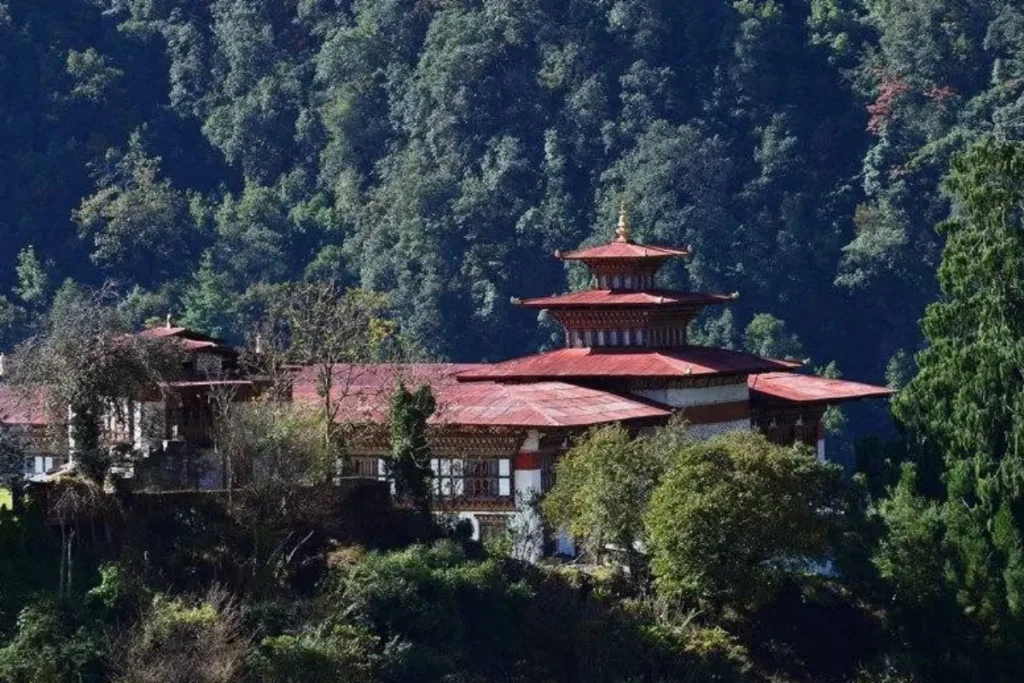
Trashiyangtse is a scenic district in northeastern Bhutan. It is known for traditional villages, Buddhist landmarks, handicrafts, and distinctive rural culture. The district covers approximately 1,435 km² and stretches from subtropical valleys toward higher mountain landscapes.
Trashiyangtse has long held religious and cultural importance because traditional routes once linked the area with Tibet and eastern Himalayan communities. The district is especially famous for Chorten Kora, traditional woodcarving, and religious handicrafts.
Traditional villages preserve Bhutanese architecture and farming practices. The surrounding forests and river valleys also create a peaceful setting for travelers who want to explore areas beyond western Bhutan.
● Chorten Kora:
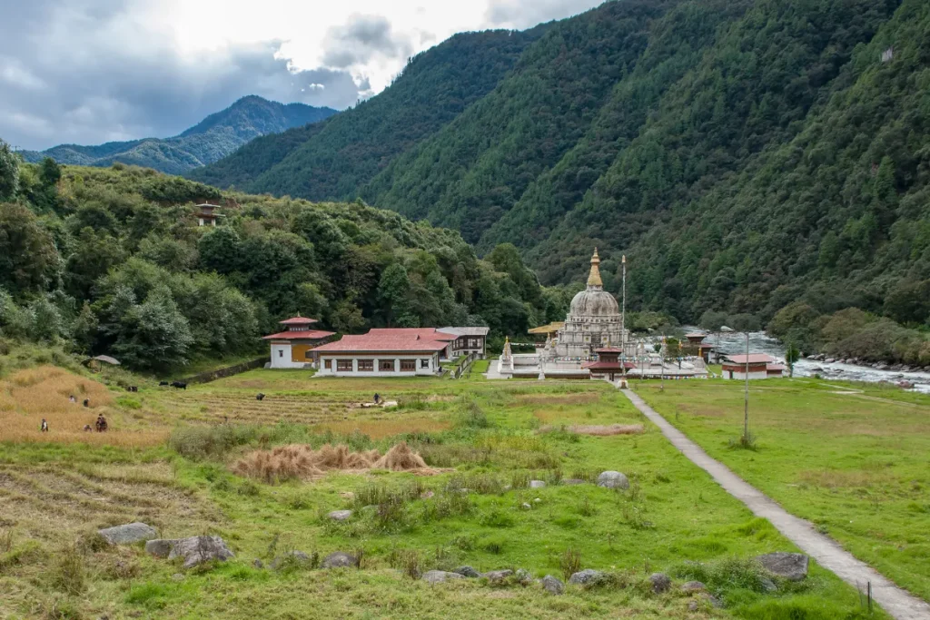
Chorten Kora is one of eastern Bhutan’s most important Buddhist pilgrimage sites. The large white stupa stands beside the Kulong Chhu River in Trashiyangtse. Lama Ngawang Loday built the chorten in the 18th century after taking inspiration from Boudhanath in Kathmandu, Nepal. According to local tradition, construction began in 1740 and ended in 1742.
The chorten hosts the annual Chorten Kora festival during the first month of the Bhutanese lunar calendar. Pilgrims from Bhutan and neighboring Arunachal Pradesh in India attend the festival. The whitewashed structure, prayer flags, surrounding mountains, and riverside setting make Chorten Kora both an important religious monument and a major cultural landmark in eastern Bhutan.
iii. Lhuentse
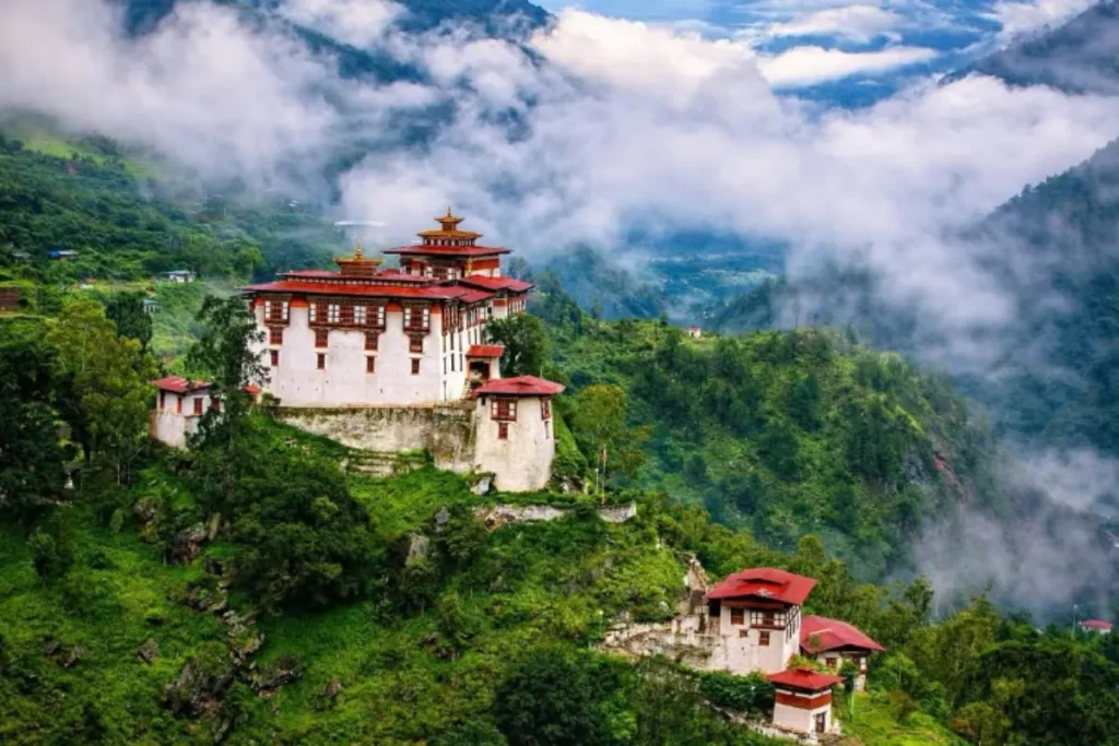
Lhuentse is a remote district in northeastern Bhutan. It covers approximately 3,000 km² and is known for its traditional culture, Buddhist heritage, and fine textile craftsmanship. The region was historically known as Kurtoe and has a close connection with Bhutan’s royal history. Ugyen Wangchuck, the first king of Bhutan, was born at Dungkar in Kurtoe in 1862. This connection makes Lhuentse important to the history of the Wangchuck dynasty.
Lhuentse also has strong weaving traditions. The village of Khoma is especially famous for its detailed textiles. Its rugged valleys, historic dzongs, traditional villages, and remote settings allow travelers to experience northeastern Bhutan’s cultural heritage away from the country’s busiest tourist routes.
● Lhuentse Dzong:
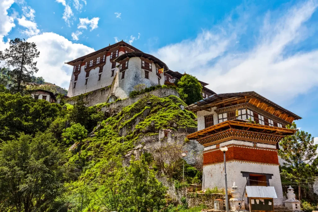
Lhuentse Dzong, also known as Kurtoe Dzong, is a historic fortress monastery overlooking the Kuri Chhu Valley. Tradition connects the original site with Lama Jangchub Dorji, who established a monastery there in the 17th century. Later, builders developed the site into an important regional fortress.
The dzong served religious and administrative purposes in the area historically known as Kurtoe. Its high position above the river gave it strategic value and created an impressive setting. Today, the dzong remains an important center of Buddhist practice and district administration. Steep mountains, forests, and traditional settlements surround it.
● Khoma Village:
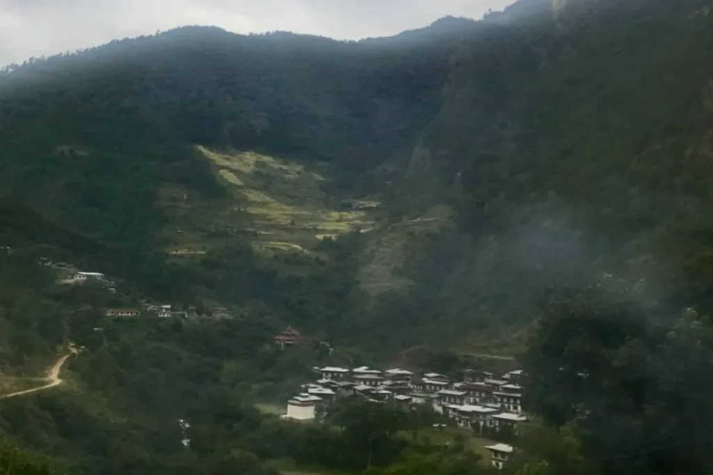
Khoma Village is one of Bhutan’s best-known traditional textile communities. The village is especially famous for Kishuthara, an intricate silk textile traditionally woven by women. Khoma lies in Lhuentse’s remote northeastern landscape, where weaving remains an important part of local culture and household livelihoods. Kishuthara features complex geometric and floral patterns. Depending on the design, weavers may need several months to complete a single piece. Families traditionally pass the craft from one generation to the next, helping preserve Bhutan’s distinctive textile heritage.
A visit to Khoma allows travelers to observe traditional weaving, meet local artisans, and experience rural village life in one of Bhutan’s most culturally important communities.
iv. Samdrup Jongkhar
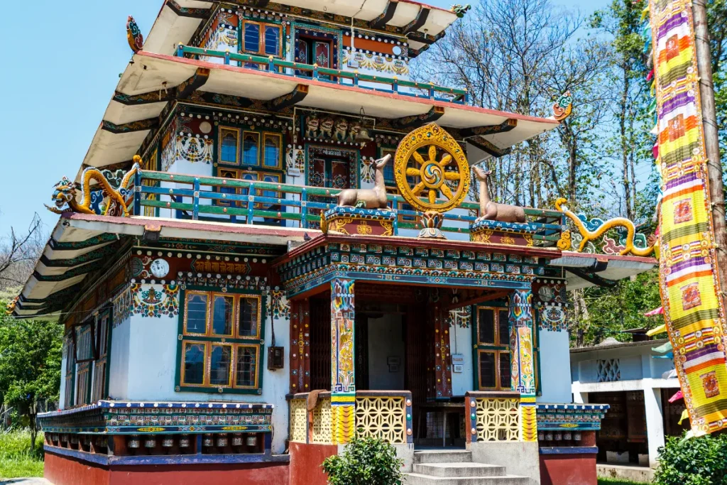
Samdrup Jongkhar is an important commercial and transportation center in southeastern Bhutan. It also serves as one of the country’s main road gateways to India. The town sits at approximately 200 meters above sea level and has a warmer subtropical climate than Bhutan’s higher valleys. The district covers roughly 1,878 km² and includes 11 gewogs. Its location along the southern foothills helped it develop as an important trading and administrative center.
Today, Samdrup Jongkhar serves as a major entry and exit point for overland travelers. It also supports trade and commerce in southeastern and eastern Bhutan, making it an important gateway to the country’s less-visited eastern regions.
v. Merak and Sakteng
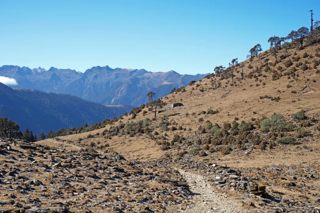
Merak and Sakteng are remote highland communities in eastern Bhutan. They are known for their distinctive Brokpa culture, traditional pastoral lifestyle, and rugged mountain scenery. The communities lie within the wider cultural landscape of Sakteng Wildlife Sanctuary, where the land rises from subtropical foothills toward high mountain areas. The Brokpa have traditionally raised yaks and cattle. They have also developed distinctive clothing, architecture, customs, and seasonal movement patterns suited to their highland environment. Their relative isolation has helped preserve cultural traditions that differ from those in many western and central parts of Bhutan.
Visitors can experience traditional village life while exploring forests, alpine meadows, and remote Himalayan landscapes.
● Sakteng Wildlife Sanctuary:
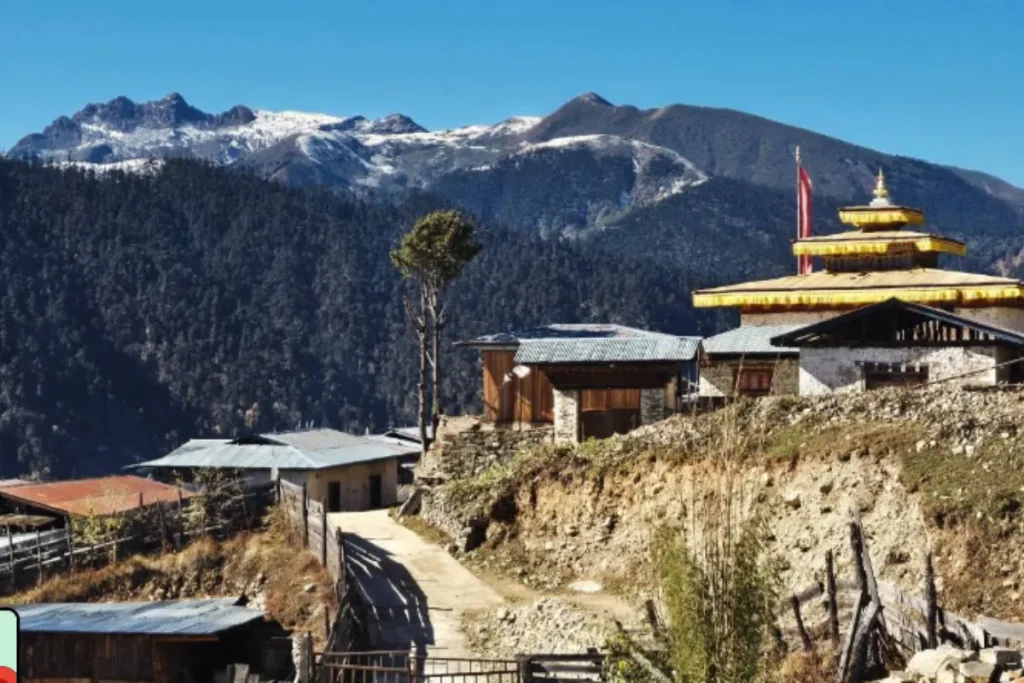
Sakteng Wildlife Sanctuary covers approximately 740 km² in eastern Bhutan. The sanctuary protects diverse forests, high-altitude landscapes, and important eastern Himalayan habitats. Bhutan established the sanctuary in 2003. It protects ecosystems that range from subtropical forests and temperate areas to alpine environments. The sanctuary has a close connection with the Brokpa communities of Merak and Sakteng. Their traditional livelihoods depend on the surrounding landscape.
The sanctuary also provides habitat for a variety of Himalayan wildlife and forms part of Bhutan’s wider network of protected areas and biological corridors. Its combination of biodiversity, mountain scenery, and living cultural traditions makes Sakteng one of eastern Bhutan’s most distinctive destinations.
4. Southern Bhutan
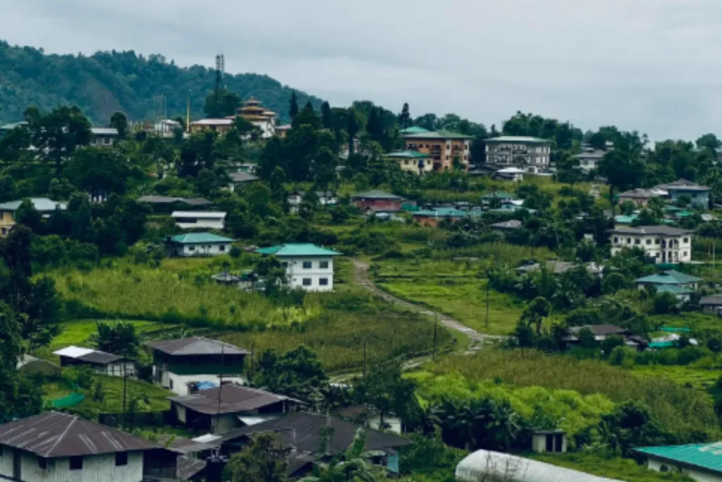
Southern Bhutan has a very different landscape from the country’s higher mountain valleys. Much of the region consists of subtropical foothills and lowland plains along the Indian border. Elevations in the southern foothills can fall below 300 meters, creating warmer conditions, dense forests, rivers, farmland, and rich biodiversity.
For travel planning, Southern Bhutan includes the dzongkhags of Samtse, Sarpang, Tsirang, Dagana, and Zhemgang. Important destinations within these areas include Phuentsholing, Gelephu, and Royal Manas National Park. Gelephu is a major town within Sarpang, while Royal Manas is one of Bhutan’s important protected areas rather than a separate dzongkhag.
Today, Southern Bhutan attracts travelers interested in wildlife, birdwatching, nature, agriculture, and overland journeys. It offers a striking contrast to Bhutan’s cooler western and central valleys.
i. Phuentsholing
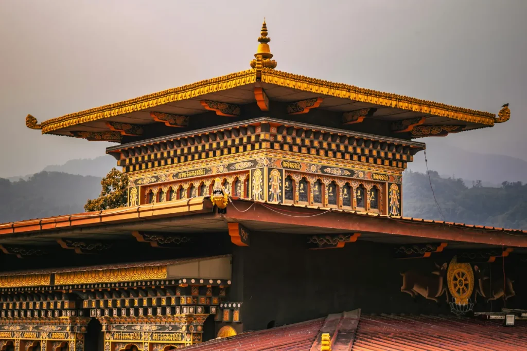
Phuentsholing is Bhutan’s main southwestern border town and one of its most important gateways to India. The town sits at approximately 300 meters above sea level and has a warm subtropical climate. The town lies beside the Amo Chhu River. Its location along the Bhutan-India border helped it develop into an important commercial and transportation center.
Jaigaon in India’s West Bengal lies directly across the border and forms part of a busy cross-border commercial area. For travelers arriving by road, Phuentsholing provides a major entry point and a practical starting place for journeys toward Thimphu, Paro, and western Bhutan.
● Amo Chhu Crocodile Breeding Centre:
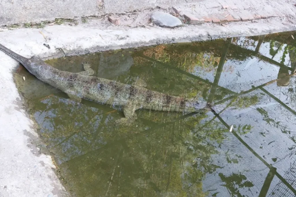
The Amo Chhu Crocodile Breeding Centre is a small wildlife conservation site near the Amo Chhu River in Phuentsholing. The center supports the conservation and breeding of marsh crocodiles, a species associated with Bhutan’s southern lowland ecosystems. Its location makes it a convenient stop for travelers entering Bhutan through Phuentsholing.
Visitors can observe crocodiles and learn about the challenges of protecting lowland wildlife. The center also reflects Bhutan’s wider commitment to biodiversity conservation in the southern foothills, where rivers, wetlands, forests, and farmland create important habitats for reptiles, birds, and other wildlife.
ii. Sarpang
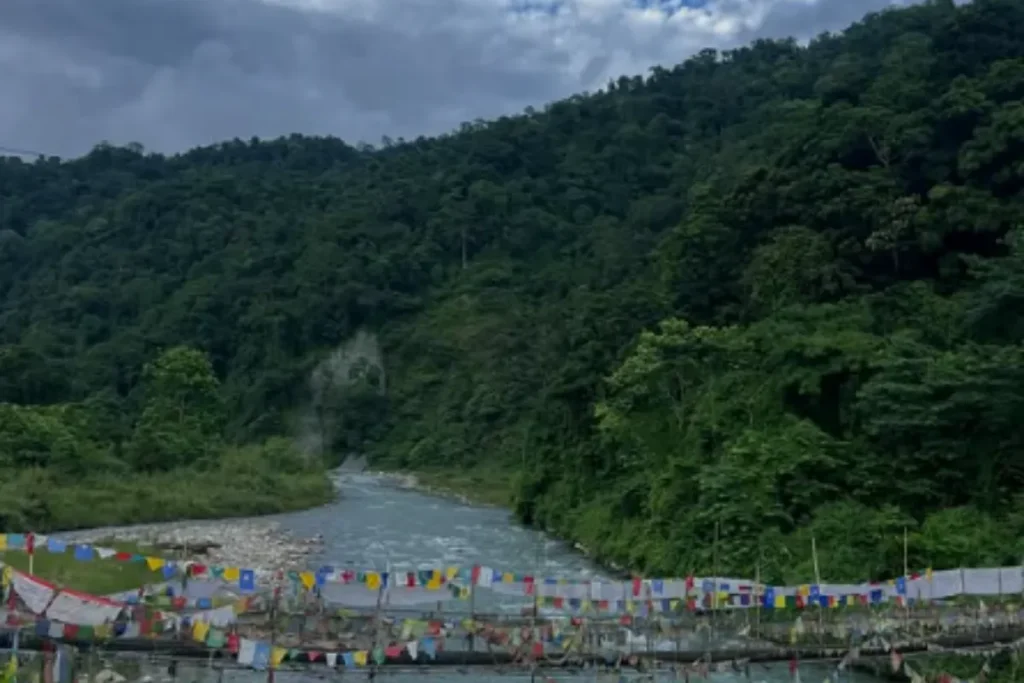
Sarpang is a subtropical district in southern Bhutan covering approximately 1,655 km². The district stretches from lowland foothills toward higher interior mountains. Its warm climate supports agriculture, forests, rivers, and diverse wildlife habitats. Sarpang also contains parts of Royal Manas National Park, one of Bhutan’s most important protected areas.
The district’s southern location gives it strong economic and transportation links with India. The southern foothills have long supported trade and movement between Bhutan and the plains. Today, Sarpang offers travelers rural communities, farmland, subtropical forests, and access to some of Bhutan’s richest biodiversity.
iii. Gelephu
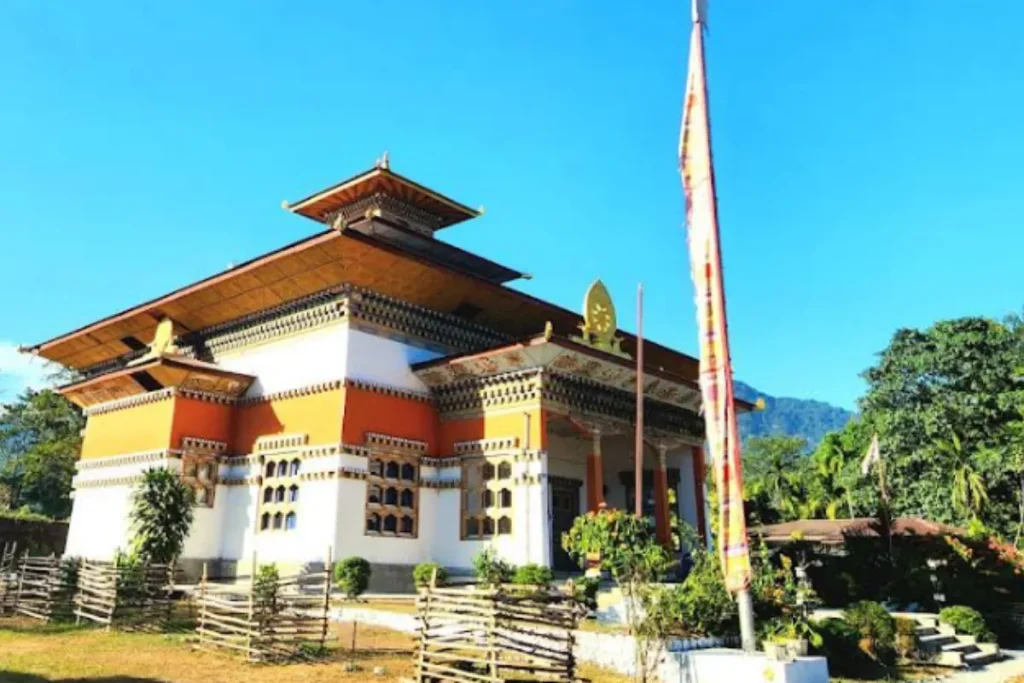
Gelephu is one of Bhutan’s major southern towns and an important overland gateway to India. The town sits in the subtropical foothills at roughly 200 meters above sea level. Gelephu has a much warmer climate than Bhutan’s central and western mountain valleys. It also serves as a commercial, administrative, and transportation center for southern and central Bhutan.
Gelephu has gained further importance through the development of Gelephu Mindfulness City, a long-term economic and urban project focused on wellness, sustainability, and connectivity. For travelers, Gelephu provides access to southern forests, rural communities, wildlife areas, and routes toward central Bhutan. This makes it an important southern base and gateway.
iv. Royal Manas National Park
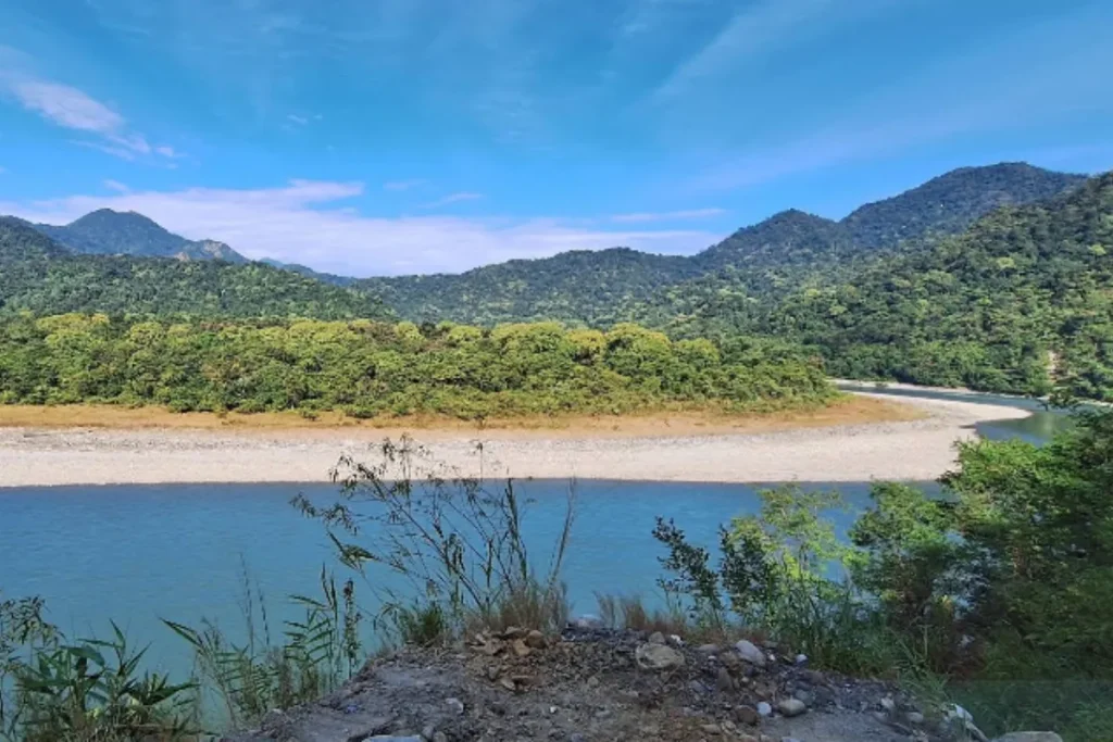
Royal Manas National Park is Bhutan’s oldest national park. The park covers approximately 1,057 km² and forms part of the larger transboundary Manas ecosystem shared with India. The park protects habitats that range from subtropical forests and rivers to higher elevations.
It supports an impressive range of wildlife, including Asian elephants, golden langurs, gaur, wild water buffalo, tigers, leopards, and many bird species. Royal Manas also connects with India’s Manas National Park, creating a larger conservation landscape across the Bhutan-India border.
For wildlife lovers, birdwatchers, nature enthusiasts, and conservation-focused travelers, Royal Manas offers one of Bhutan’s richest natural experiences.
● Manas:
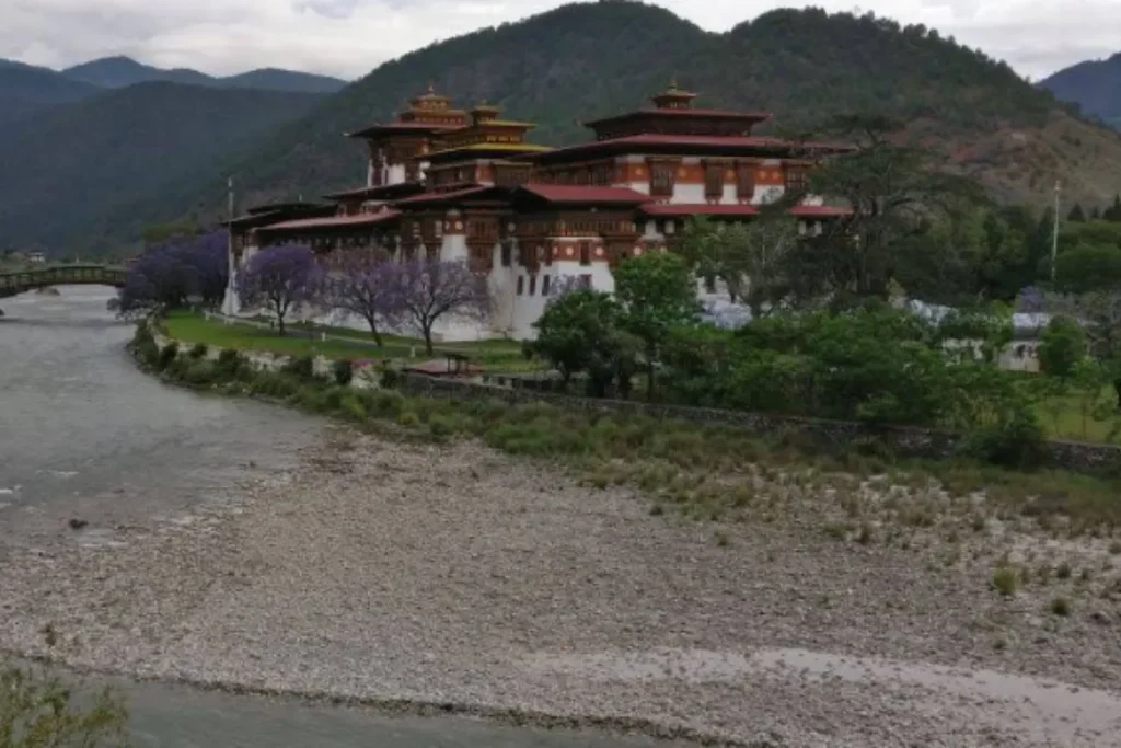
The Manas area forms part of the southern landscape of Royal Manas National Park and is one of Bhutan’s most important subtropical ecosystems. The region has warm lowland conditions, rivers, dense forests, grasslands, and diverse wildlife habitats. The wider Manas landscape supports species such as elephants, gaur, golden langurs, and many birds and reptiles. Its position along the Bhutan-India border also gives it international conservation importance as part of the wider Manas transboundary ecosystem. Travelers can explore the area through wildlife observation, birdwatching, river-based experiences, and nature walks. Manas also offers a chance to experience Bhutan’s tropical side.
v. Samtse
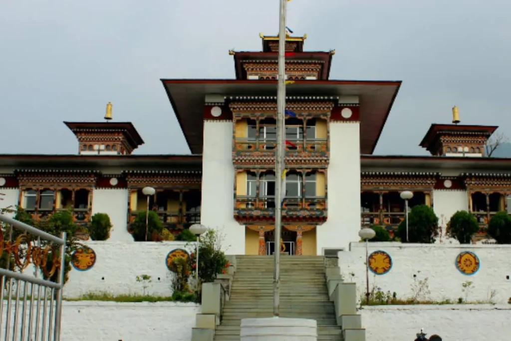
Samtse is a southwestern Bhutanese district with subtropical forests, farmland, river valleys, and diverse communities. It covers approximately 1,500 km² and stretches along Bhutan’s border with India. The district includes some of Bhutan’s warmest and lowest-elevation landscapes. Samtse also serves as one of Bhutan’s recognized road entry points from India, which gives it historical and economic importance.
Agriculture remains an important part of local life, while surrounding forests support the region’s biodiversity. Samtse receives fewer international visitors than destinations such as Paro and Thimphu. As a result, it suits travelers who want to explore rural landscapes, local communities, farming areas, and southern Bhutanese life.
vi. Tsirang
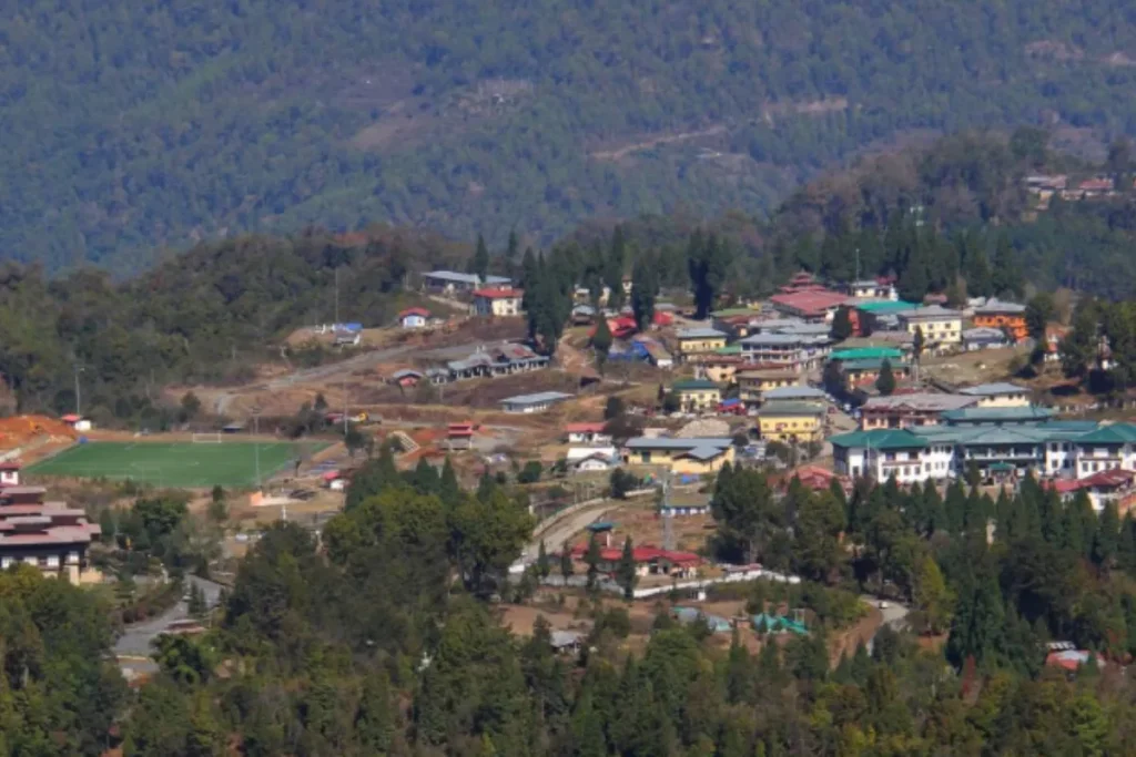
Tsirang is a fertile district in south-central Bhutan. It covers approximately 638 km² and features rolling hills, forested slopes, valleys, and productive farmland. Farmers grow mandarins, vegetables, rice, maize, and other crops that suit the district’s mild climate. Tsirang’s elevation changes across the district, creating a transition between subtropical lowlands and higher interior areas.
The district developed mainly around farming and rural settlements rather than major fortress centers. Today, Tsirang offers a quieter view of Bhutan, where fields, orchards, villages, forests, and mountain views reveal the country’s agricultural traditions.
vii. Dagana
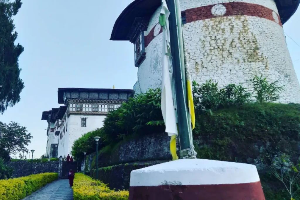
Dagana is a mainly rural district in southwestern Bhutan. It covers approximately 1,723 km² and features steep forested hills, agricultural valleys, and scattered traditional settlements. Much of Dagana lies away from Bhutan’s main tourist routes, which gives the district a peaceful character. The landscape changes from subtropical areas to higher mountain environments. This variation supports diverse vegetation and wildlife habitats.
Dagana Dzong has served as an important administrative and defensive center for the region, reflecting the wider role of dzongs in Bhutanese governance. Today, Dagana suits travelers who want to explore rural Bhutan, traditional communities, forests, farming landscapes, and less-visited areas rather than conventional sightseeing destinations.
viii. Zhemgang
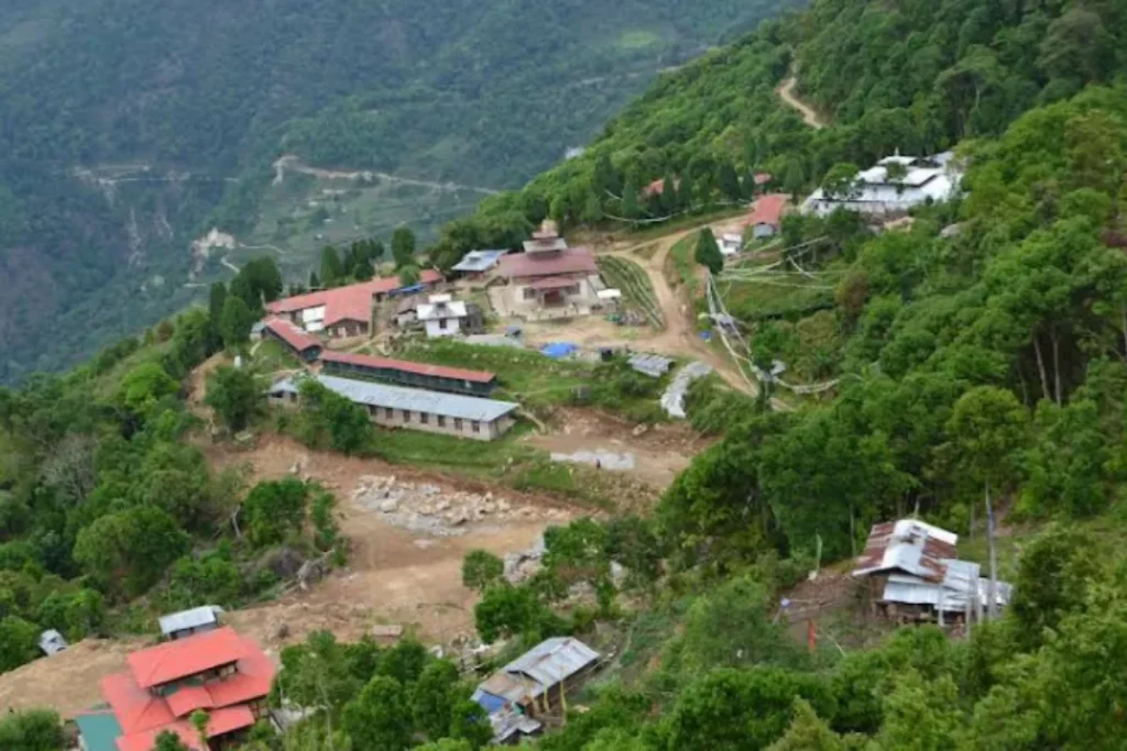
Zhemgang is a mountainous district in south-central Bhutan. It covers approximately 2,421 km² and is well known for its forests and rich biodiversity. Much of the district remains heavily forested. The landscape ranges from subtropical river valleys to higher mountain terrain.
Zhemgang has strong ecological links with Royal Manas National Park and other protected areas in southern Bhutan. The region provides habitat for many Himalayan and subtropical species and offers excellent opportunities for birdwatching and nature-based travel. Its remote location has also helped preserve traditional communities and rural lifestyles. For visitors, Zhemgang offers dense forests, dramatic mountains, wildlife, villages, and opportunities to explore parts of Bhutan that receive fewer tourists.
● Tingtibi:
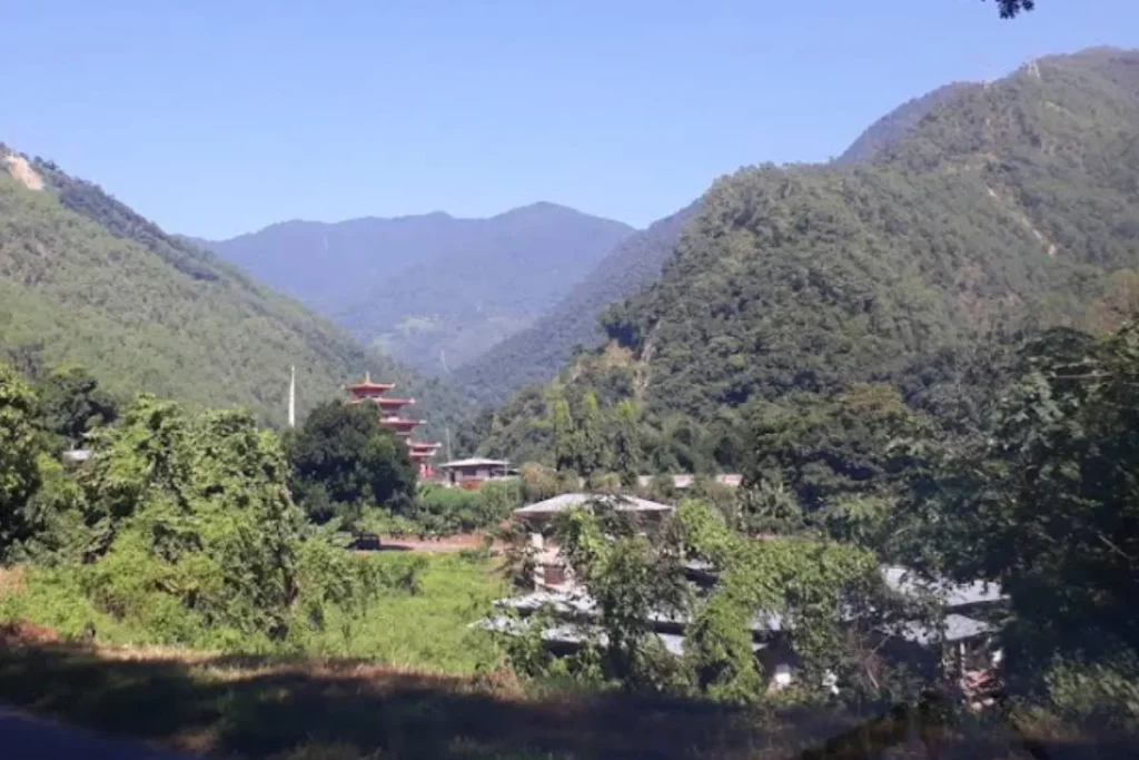
Tingtibi is a small settlement in Zhemgang surrounded by forested mountains, rivers, and rich natural habitats. The settlement lies in a biologically diverse part of south-central Bhutan where subtropical and Himalayan ecosystems meet. The wider Zhemgang region supports many bird species and other wildlife, making Tingtibi attractive to nature lovers and birdwatchers.
The settlement also offers a glimpse into rural Bhutan. Agriculture and traditional communities remain important parts of local life. Because Tingtibi lies away from Bhutan’s main tourist centers, it provides a useful stop for travelers exploring southern Bhutan’s forests, wildlife, villages, and less-developed mountain landscapes.
6. Best Places to Visit in Bhutan for First-Time Visitors
Bhutan has more attractions than most travelers can fit into one trip, so your ideal itinerary depends on how long you have. For a first visit, start with Paro, Thimphu, and Punakha. Together, these destinations introduce you to Bhutanese culture, history, architecture, religion, and mountain scenery. Paro gives you access to Tiger’s Nest and Rinpung Dzong.
Thimphu introduces you to the country’s capital and its important cultural and religious landmarks. Punakha adds its historic dzong, fertile valley, and warmer climate. If you have more time, add Phobjikha Valley and Gangtey for highland scenery and black-necked cranes. Haa Valley offers quieter village experiences, while Bumthang provides a deeper look into Bhutan’s Buddhist heritage.
Best Places in Bhutan for Culture and History
Bhutan spreads its cultural attractions across valleys and districts rather than concentrating them in one city. A strong cultural itinerary combines dzongs, ancient temples, monasteries, festivals, and traditional villages.
i. Historic Dzongs
Punakha Dzong ranks among Bhutan’s most important historic and religious monuments. Rinpung Dzong introduces visitors to Paro’s distinctive fortress architecture. Trongsa Dzong demonstrates the strategic importance of central Bhutan, while Tashichho Dzong remains closely connected with the country’s government and religious institutions.
In eastern Bhutan, Lhuentse Dzong provides another important example of Bhutanese architecture and regional history. Together, these dzongs show how Bhutan developed its religious, administrative, and political traditions across different regions.
ii. Ancient Temples and Monasteries
For Buddhist heritage, begin with Kyichu Lhakhang in Paro. Then continue to Jambay Lhakhang, Kurjey Lhakhang, and Tamshing Lhakhang in Bumthang. Gangtey Monastery offers a different experience in the highland landscape of Phobjikha.
Khamsum Yulley Namgyal Chorten combines Buddhist architecture with a scenic rural setting above Punakha Valley. These sites help travelers understand Bhutan through its religious traditions rather than through sightseeing alone.
iii. Traditional Villages
Bhutan’s villages provide a more personal view of everyday life. Khoma in Lhuentse is famous for traditional weaving. Merak and Sakteng in eastern Bhutan introduce visitors to distinctive highland communities.
Laya offers another remote Himalayan cultural experience, while Phobjikha combines traditional settlements with dramatic highland scenery. Village visits can include walks, local food, handicrafts, farm activities, and community-based tourism experiences.
iv. Best Places for Buddhist Heritage
For a focused Buddhist journey, prioritize Paro, Punakha, Bumthang, and Trongsa before extending your trip into eastern Bhutan. Paro offers some of Bhutan’s best-known sacred sites.
Punakha connects travelers with the religious history of the Zhabdrung period. Bumthang contains numerous ancient temples, while Trongsa shows the historical relationship between religion, regional power, and Bhutan’s unification.
Best Places in Bhutan for Nature and Wildlife
Bhutan rewards nature-focused travelers with dramatic changes in altitude and landscape. The country moves from subtropical forests in the south to temperate valleys and high Himalayan environments in the north.
The official tourism portal highlights national parks, wildlife sanctuaries, and diverse habitats across the country.
i. Best Valleys
Phobjikha Valley is ideal for highland scenery, nature walks, and black-necked crane watching. Haa Valley offers quiet mountain landscapes and traditional communities.
Paro Valley combines farmland with historic monuments. Bumthang’s valleys bring together forests, farmland, monasteries, and mountain scenery. For a more remote experience, Laya Valley takes travelers into high-altitude landscapes and provides access to some of Bhutan’s most demanding trekking routes.
ii. Wildlife Destinations
Royal Manas National Park ranks among Bhutan’s premier wildlife destinations. Jigme Dorji National Park stretches from lower forests to glaciers and high Himalayan peaks.
Sakteng Wildlife Sanctuary protects important eastern Himalayan habitats, while Bumdeling Wildlife Sanctuary provides an important winter habitat for black-necked cranes. Bhutan’s official tourism information highlights the country’s exceptional range of wildlife across these protected areas.
iii. Places for Birdwatching
Phobjikha Valley is Bhutan’s best-known destination for black-necked cranes. Bumdeling Wildlife Sanctuary provides another important winter habitat. Royal Manas National Park offers highly diverse subtropical birdlife, while Sakteng provides opportunities to explore eastern Himalayan forests.
Black-necked cranes generally reach their Bhutanese wintering grounds around September and October and return toward Tibet between February and March.
iv. Places for Mountain Scenery
Dochula Pass offers one of the easiest ways to enjoy Himalayan views during a western Bhutan itinerary. Haa Valley provides broad mountain scenery without requiring a major trek. Laya and Lunana take travelers into much higher and more remote Himalayan terrain.
Phobjikha combines open valley scenery with surrounding mountains and forests, making it especially attractive for photography, walking, and nature-focused travel.
Best Time to Visit Bhutan
Bhutan welcomes travelers throughout the year, but the best season depends on what you want to do. Spring and autumn generally provide the best conditions for sightseeing and trekking. Summer brings lush greenery but also monsoon rain. Winter offers clear skies, fewer visitors, and excellent opportunities for black-necked crane watching.
● Spring, March to May
Spring brings pleasant temperatures, blooming rhododendrons, green valleys, and ideal conditions for sightseeing and trekking. The season also includes important festivals.
Travelers can watch masked dances, religious ceremonies, and traditional celebrations. March to May works especially well for combining cultural experiences, nature, photography, and outdoor activities.
● Summer, June to August
Summer creates lush green landscapes and vibrant agricultural scenery across Bhutan. However, the monsoon brings frequent rainfall, especially from July onward. Heavy rain can sometimes cause landslides, road delays, and travel disruptions.
Summer suits travelers who enjoy green landscapes and quieter destinations. Keep your schedule flexible because weather conditions can change travel plans.
● Autumn, September to November
Autumn brings clearer skies, comfortable daytime temperatures, excellent mountain views, and ideal trekking conditions. October and November generally provide more settled weather than early September. The season also brings major festivals and the beginning of the black-necked crane season in places such as Phobjikha and Bumdeling. Autumn, therefore, works especially well for travelers who want to combine culture and nature.
● Winter, December to February
Winter brings cold temperatures, clear skies, and fewer visitors across many parts of Bhutan. Paro and Thimphu require warm clothing, while higher mountain areas can experience snow and freezing conditions.
Winter works especially well for peaceful sightseeing, clear Himalayan views, and black-necked crane watching in Phobjikha and Bumdeling.
How Many Days Do You Need in Bhutan?
i. 4–5 Days in Bhutan
A four- to five-day trip works best for Paro and Thimphu. You can visit Tiger’s Nest and the major cultural sights without spending too much time on the road. Keep your route compact so that long drives do not take up most of your trip.
ii. 6–7 Days in Bhutan
Six to seven days give you enough time to visit Paro, Thimphu, and Punakha. This route provides a balanced introduction to Bhutan’s culture, history, architecture, and mountain scenery.
iii. 8–10 Days in Bhutan
Eight to ten days allow you to add Phobjikha and Gangtey. You can enjoy a more relaxed western Bhutan journey with time for nature walks, monasteries, villages, and wildlife experiences.
iv. 10–14 Days in Bhutan
Ten to fourteen days work well for combining western and central Bhutan. You can include destinations such as Trongsa and Bumthang and spend more time exploring Bhutanese culture instead of rushing through major highlights.
v. 14+ Days in Bhutan
Two weeks or more gives you enough time to explore eastern Bhutan, southern wildlife destinations, remote villages, and trekking regions. A longer trip also allows you to slow down and visit places that do not fit easily into a short holiday.
Choosing the Right Places to Visit in Bhutan
The best destinations depend on what you want from your trip. If you are visiting Bhutan for the first time, start with Paro, Thimphu, and Punakha. Add Phobjikha for nature, Bumthang for deeper Buddhist heritage, Haa for quieter village experiences, and eastern Bhutan for remote communities and less-visited landscapes.
Travelers interested in wildlife should prioritize Royal Manas, Jigme Dorji, Bumdeling, or Sakteng. Trekkers should choose their route based on difficulty, season, and available time. Bhutan’s official tourism portal lists trekking routes by difficulty and season. Use this information to match a trek with your itinerary.
| If you want | Go to |
| Bhutan’s most iconic landmark | Paro |
| Buddhist heritage | Paro, Punakha, Bumthang |
| Bhutanese history | Punakha, Trongsa, Paro |
| Himalayan scenery | Dochula, Haa, Laya, Phobjikha |
| Wildlife | Royal Manas, Jigme Dorji, Bumdeling, Sakteng |
| Black-necked cranes | Phobjikha, Bumdeling |
| Trekking | Jomolhari, Druk Path, Laya-Gasa, Bumdra, Merak-Sakteng, and other established trekking routes |
| Remote villages | Laya, Merak, Sakteng, Khoma |
| First-time experience | Paro, Thimphu, Punakha |
| A longer cultural journey | Bumthang and Eastern Bhutan |